
Our Mission
GEOFON seeks to facilitate cooperation in seismological research and earthquake and tsunami risk mitigation by providing rapid transnational access to seismological data and source parameters of large earthquakes, and keeping these data accessible in the long term.
It pursues these aims by operating and maintaining a global network of permanent seismic stations in cooperation with local partners, facilitating real-time access to data from this network and those of many partner networks and plate boundary observatories, and providing a FAIR archive for seismological data. It also curates data from temporary experiments carried out by scientists at German universities and institutions and international partners, thereby fostering cooperation and encouraging the full exploitation of all acquired data and serving as the permanent archive for the Geophysical Instrument Pool at Potsdam (GIPP).
Using real-time data streams, GEOFON provides rapid automatic earthquake parametric information to the scientific community, tsunami warning centres worldwide, organizations involved in rescue operations, news media and the general public. The GEOFON earthquake monitoring system acts as key node for rapid global earthquake information for the European-Mediterranean Seismological Centre (EMSC) and contributes its parametric data to the International Seismological Centre (ISC).
GEOFON develops and improves methods of rapid analysis of real-time data including methods integrating citizen science approaches, works at the forefront of software development to incorporate new methodological developments into its data processing and analysis and to improve ease of access, e.g. for data science applications. In this endeavour it cooperates with other national and international data centres in the setting of standards of seismological data exchange.
The access to data and earthquake parameters contributes to basic research into Earth structure and dynamics, primarily of the solid Earth, but also the hydrosphere and atmosphere, applied research related to the hazard from large earthquakes and tsunamis, seismic monitoring for hazard mitigation purposes by national and transnational agencies, and rapid information of the general public.
By participating in training and capacity building, GEOFON promotes the dissemination of knowledge and helps to raise the stand of seismological service provision in many regions.
GEOFON is part of the Modular Earth Science Infrastructure MESI housed at the GFZ providing data and services to external as well as internal users according to community standards.
It directly supports the Helmholtz mission by providing the scientific infrastructure, in the form of the global seismic network, a seismological data centre and earthquake monitoring facilities, to research the complex system Earth. It thus contributes to solving the grand challenge of better understand and mitigate the impact on the society of extreme and cascading events, specifically mitigating the risk from earthquakes and tsunamis.
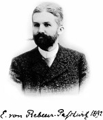
Wir wollen in erster Linie die Gründung eines internationalen Netzes von Erdbebenstationen in Anregung bringen, dessen Aufgabe es sein soll, die Ausbreitung der von großen Erdbebencentren ausgehenden Bewegungen auf der Erdoberfläche und durch den Erdkörper in systematischer Weise zu beobachten.
Primarily we would seek the establishment of an international network of earthquake stations, whose purpose would be to systematically observe the propagation of movements generated at earthquake centers, along the Earth's surface and through its interior.
GEOFON related publications
-
Quinteros, J., Strollo, A., Evans, P., Hanka, W., Heinloo, A., Hemmleb, S., Hillmann, L., Jäckel, K.-H., Kind, R., Saul, J., Zieke, T., Tilmann, F. (2021): The GEOFON Program in 2020. - Seismological Research Letters, 92, 3, 1610-1622. https://doi.org/10.1785/0220200415
-
Quinteros, J., Carter, J. A., Schaeffer, J., Trabant, C., Pedersen, H. A. (2021): Exploring Approaches for Large Data in Seismology: User and Data Repository Perspectives. - Seismological Research Letters, 92, 3, 1531-1540. https://doi.org/10.1785/0220200390
-
Strollo, A., Cambaz, D., Clinton, J., Danecek, P., Evangelidis, C. P., Marmureanu, A., Ottemöller, L., Pedersen, H., Sleeman, R., Stammler, K., Armbruster, D., Bienkowski, J., Boukouras, K., Evans, P., Fares, M., Neagoe, C., Heimers, S., Heinloo, A., Hoffmann, M., Kaestli, P., Lauciani, V., Michalek, J., Odon Muhire, E., Ozer, M., Palangeanu, L., Pardo, C., Quinteros, J., Quintiliani, M., Antonio Jara-Salvador, J., Schaeffer, J., Schloemer, A., Triantafyllis, N. (2021): EIDA: The European Integrated Data Archive and Service Infrastructure within ORFEUS. - Seismological Research Letters, 92, 3, 1788-1795. https://doi.org/10.1785/0220200413
-
Hanka, W., Saul, J., Weber, B., Becker, J., Harjadi, P., Fauzi, GITEWS Seismology Group (2010): Real-time earthquake monitoring for tsunami warning in the Indian Ocean and beyond. - Natural Hazards and Earth System Sciences (NHESS), 10, 12, 2611-2622. https://doi.org/10.5194/nhess-10-2611-2010
- Hanka, W. Kind, R. (1994): The GEOFON Program. - Annali di Geofisica Vol. 37, 5, 1060-1065.