

GEOFON Annual Report 2019¶
| Authors: | Angelo Strollo, Peter Evans, Andres Heinloo, Susanne Hemmleb, Laura Hillmann, Karl-Heinz Jäckel, Javier Quinteros, Joachim Saul, Riccardo Zaccarelli, Thomas Zieke and Frederik Tilmann. |
|---|
| Citations: | Recommended citation for the report: Strollo, A., Evans, P., Heinloo, A., Hemmleb, S., Hillmann, L., Jäckel, K.-H., Quinteros, J., Saul, J., Zaccarelli, R., Zieke, T., & Tilmann, F. (2020). GEOFON Annual Report 2019. In Scientific Technical Report STR; 20/03 (Version 2.2). GFZ German Research Centre for Geosciences. https://doi.org/10.2312/GFZ.B103-20035 |
|---|
Executive summary¶
- One additional station was added to the GEOFON Global Seismic Network in Germany at the Falkenstein castle (Harz, Sachsen-Anhalt) with station code FALKS. 45 stations required corrective maintenance actions. The GEOFON engineering team performed on-site maintenance at 8 sites, whereas 37 stations were serviced from remote and/or repaired by our local partners. For 13 stations spare parts were assembled and tested in Potsdam and delivered to the local partners. The Week Number Roll Over (WNRO) expected to affect GPS receivers in 2019 required a large effort to prepare and fix a substantial number of stations affected.
- The GFZ Seismological Data Archive hosted at GEOFON has grown by ~18 TB in 2019. The total size of the archive is ~118 TB including 137 networks and 4558 stations. Tailor-made requests from the archive have been served to more than 2700 unique users, which cumulatively made more than 190 million requests for 270+ million time windows. Real-time data export has increased slightly to ~160 TB/year to more than 300 clients. At the end of the year EPOS-IP (EU) and GDN (BMBF) projects have ended. The EIDA Next Generation services, the adoption of persistent identifier (PID) for seismic instruments (of GIPP) and improved data policies for seismic data at the GFZ are the main outcomes of the two projects.
- GEOFON published 4657 events and 905 moment tensor solutions via the web pages and other dissemination channels. The paper co-authored with staff at the EMSC and the Hungarian Academy of Science has been published by Science Advances, demonstrating the benefits of using CrowdSeeded locations (CsLoc) to reduce the the publication delay to 1.7 min (median value for analysed data set). Aiming at introducing a new service providing the Energy Magnitude in real-time we started testing, in cooperation with ISC and Section 2.6, the procedure proposed by Di Giacomo et al., 2008.
- Software development focused on preparing the new version of SeisComP 4.0.0 AGPL in cooperation with gempa GmbH for release in spring 2020. Another major activity has been the redesign of the web pages launched in October. The new web site has been optimised for mobile devices which is from where the majority of our users are coming today. The authentication service developed for EIDA has been successfully rolled out and used for the first time to access restricted data in EIDA via standard fdsn web services (AlpArray).
Introduction¶
The GEOFON program consists of a global seismic network (GE Network), a seismological data centre (GEOFON DC) and a global earthquake monitoring system (GEOFON EQinfo). These three pillars are part of the MESI research infrastructure of the Helmholtz Centre Potsdam - GFZ German Research Centre for Geosciences aiming at facilitating scientific research. GEOFON provides real-time seismic data, access to its own and third party data from the archive facilities as well as global and rapid earthquake information. The GEOFON Seismological Software can be considered a fourth cross-cutting module of the GEOFON Program.
Data, services, products and software openly distributed by GEOFON are used by hundreds of scientists and data centres worldwide. Its earthquake information service is accessed directly by tens of thousands of visitors. The SeisComP software package is the flagship software provided to the community, which is geared for seismic observatory and data centre needs and used extensively to support our internal operations. As all other MESI (Modular Earth Science Infrastructure) modules GEOFON has the majority of users outside the GFZ as well as an external advisory committee that provides advice to the GFZ Executive Board and to the GEOFON team. This report describes the main activities carried out within the three GEOFON pillars and the software development group.
The GEOFON global seismic network¶
The GEOFON network at the end of 2019 consisted of 89 GEOFON stations (mostly distributed under the GE network code, but also including the 4 former GE stations today distributed under the WM seismic network code and WM.TIO) (Fig. 1). One new station was added to the GEOFON Global Seismic Network in Germany at the Falkenstein castle with station code FALKS.
Installation of the Falkenstein (FALKS) station in Germany provides better coverage for local and regional earthquakes in the Sachsen-Anhalt region. The site has been selected with the intention to have also a test site not too distant from the GFZ. The station is equipped currently with the Trillium 360 seconds BB sensor and a Quanterra (Q330S) digitizer. We plan to replace the sensor with a 120 seconds in the near future. We keep on exploring better locations in the region in coordination with the local colleagues and BGR.
The GPS Week Number Roll Over, although expected in April and prepared in advance, demanded substantial effort in summer. The GEOFON engineers, already at the beginning of the year, contacted directly the GPS boards producers to get exact dates for the boards in use of the WNRO. Unfortunately for some of our digitizer was not possible to uniquely identify the GPS board in use. Most of these digitizers (~30 units in our networks) from EarthData were indeed suddenly affected on Sunday 28.07.2019. A patch for the EarthData seedlink plug-in was quickly deployed at all stations from remote and on the next Monday we had almost all stations back in operation.
During the WNRO crises we managed to re-establish the connection with the Pulkovo (PUL, Russia) station operator and since then we are receiving again data as well as we back filled the archive for the previous years.
Four of the GEOFON stations have not delivered any data in 2019 (SOCY and DAMY in Yemen, LVC in Chile and KERA in Greece) due to civil war in the country or political issues. The LVC station in Chile, operated in cooperation with the IRIS/GSN, was vandalised in November 2018. Despite the complex issues we are facing with these stations we hope to have them back online in the future, thus keep their epochs open.
The average availability for the network excluding the new and four non-working stations is at 93%.
Regular maintenance¶
45 GEOFON stations required corrective maintenance actions. The GEOFON engineering team performed on-site maintenance at 8 of these sites (NPW in Myanmar; KAAM and HMDM in the Maldives; FALKS, RGN and IBBN in Germany; SANT in Greece; SUMG in Greenland), whereas 37 stations were repaired remotely and/or by our local partners. Here, it was necessary in 13 cases to assemble and test spare parts in Potsdam and deliver them to the local partners (Figure 1). The large number of stations demanding maintenance has been caused by the WNRO issue, not only to apply the patch to the EartData but also to check/upgrade firmwares to all other stations running old firmware versions.
Fig. 1 GEOFON stations in 2019. Colours denote the data availability (white: 0% to red: 100% availability). Symbols represent the level of maintenance needed: circle for “none”, square for “on site”, triangle (up) for “remote”, triangle (down) for “Remote including HW shipment”. An “X” next to the symbol indicates metadata updates.¶
Technical developments¶
R&D efforts were mainly directed at exploring possibilities to replace the actual PC in use at the stations, the so called seiscompbox. A prototype next generation seiscompbox has been developed bringing together the functionality of the Teltonika routers and the seiscompbox. This prototype is based on openWRT (seiscompWRT) and includes raspberrypi, solid state disk, UMTS stackable modules, power management and a number of additional switch options through the GPI board (e.g. mass centering, power cycle, etc) tests will be carried out in the near future. Redmine has been adopted as tracking and documentation system for the network.
Technical support to other GFZ groups (e.g. Observatories)¶
The engineering group also provided support to other projects/groups within and outside the GFZ. Within our own section (2.4) we supported the field activities of a temporary campaign in Myanmar. A substantial effort went into supporting the Integrated Plate Boundary Observatory Chile (IPOC) seismic network in remote support and migration of the documentation into the Redmine system. Support has been provided to GFZ colleagues to prepare instruments for a strong motion network in Myanmar and to other external partners during the WNRO crises. Last but not least the GEOFON group continuously provided assistance to our long term partner BMKG in Indonesia to run their seismic network and data centre for tsunami early warning.
Annexes¶
A comprehensive report on engineering actions is provided as separate document linked at the end of the report.
The GEOFON Data Centre¶
Archive Service Delivery¶
The GFZ Seismological Data Archive hosted at GEOFON has grown by ~18 TB in 2019, similar to the previous year, with most of the added data having been acquired by temporary networks between 2014 and 2019, but also with some old data dating back to 2003 (Fig. 2). The archive (total size ~118 TB, Fig. 3) was completely integrated in the GFZ computing centre infrastructure within 2019. Substantial effort has been done to migrate from own storages (SAN-type storage, which were attached to VMs as block device) to the computing centre facilities (NAS-type storage, which is attached via NFS). The filesystem is now mirrored in two physical locations and monthly snapshots are provided. With this new approach we spare one replica of the data, only replicating once off-site at KIT. An additional advantage is that the filesystem can be dynamically expanded and mounted on multiple machines (eg., geofon1h and geofon2h) at the same time. Thus the GEOFON archive is also ready to scale up in case of sudden exponential demand of new storage space driven by emerging technologies such as DAS, Large-N etc. Most of the data were served to the 2700+ users of the archive via fdsnws, in total almost 150 million requests (34 TB), compared to 45 million via arclink (4 TB). After a decade of usage, arclink service was switched off with end of the year. To facilitate the transition we provided dedicated documentation and an alternative client to arclink_fetch named fdsnws_fetch which is able to handle arclink_fetch input files but based on FDSN standard web services. The new client supports also authentication and thus able to access restricted/embargoed data (e.g. AlpArray). Real-time data export has increased slightly to ~160 TB/year to more than 300 clients.
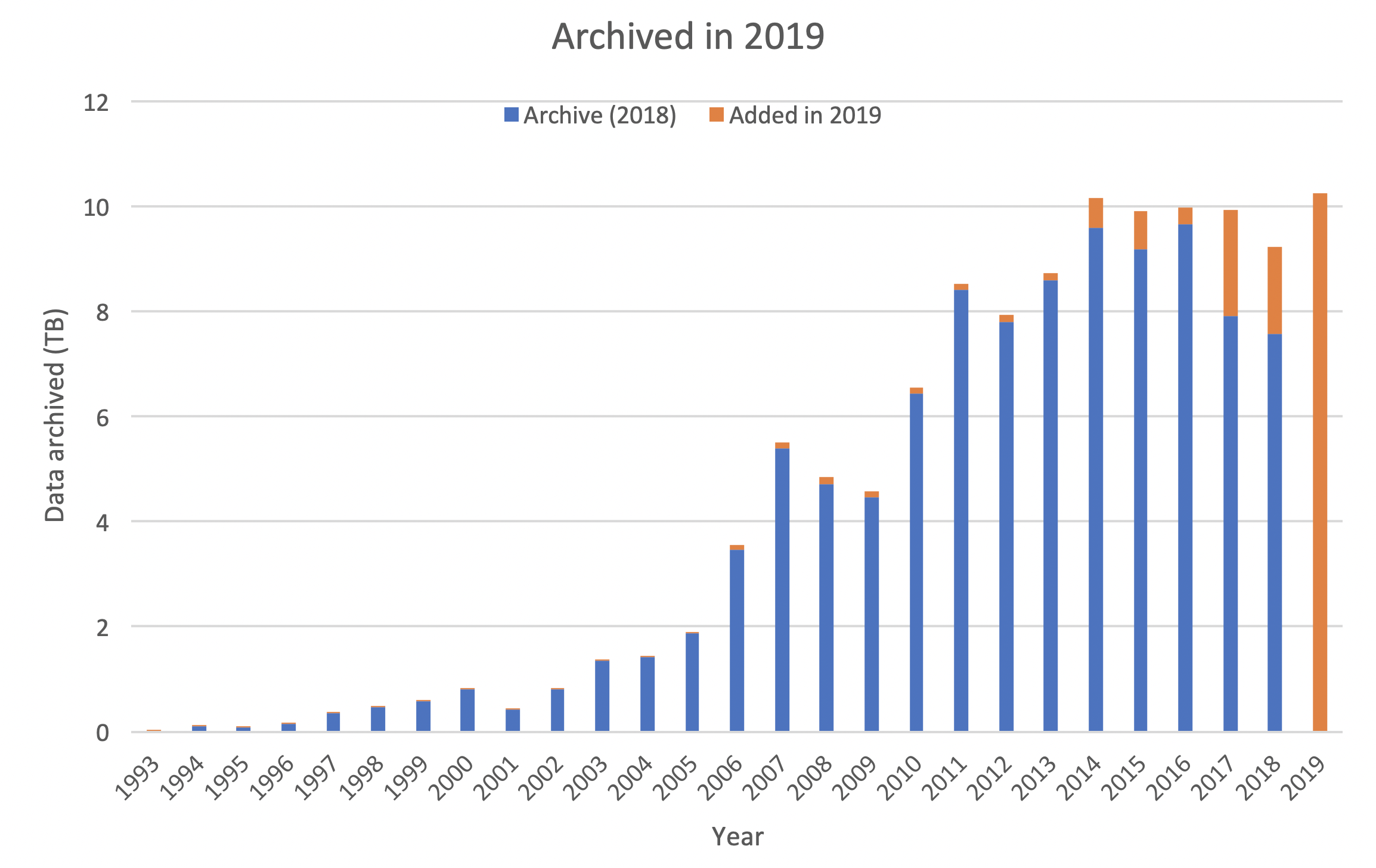
Fig. 2 Data archived by year of acquisition.
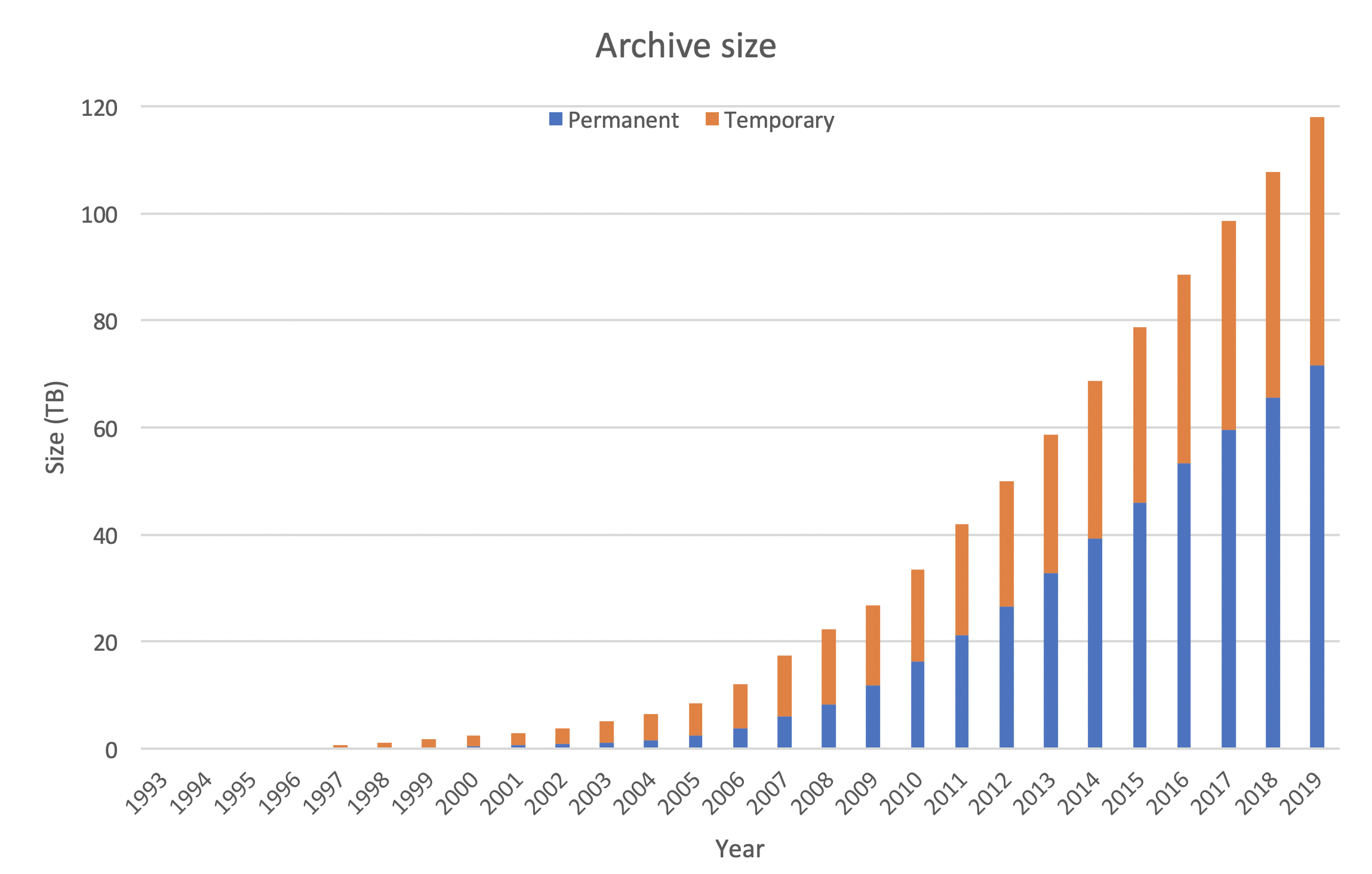
Fig. 3 Cumulative size of the GEOFON archive.
Requests by method and by type.
| Request method | Requests | Timewindows | Volume | Users |
|---|---|---|---|---|
| fdsnws (external) | 142.734.001 | 195.614.480 | 31 TB | 2496 |
| fdsnws (GFZ) | 4.624.779 | 11.830.774 | 3 TB | 175 |
| arclink (external) | 45.567.806 | 59.998.062 | 4 TB | 1040 |
| arclink (GFZ) | 134.963 | 620.619 | 1 GB | 38 |
| Total | 193.061.549 | 268.063.935 | 38 TB | x |
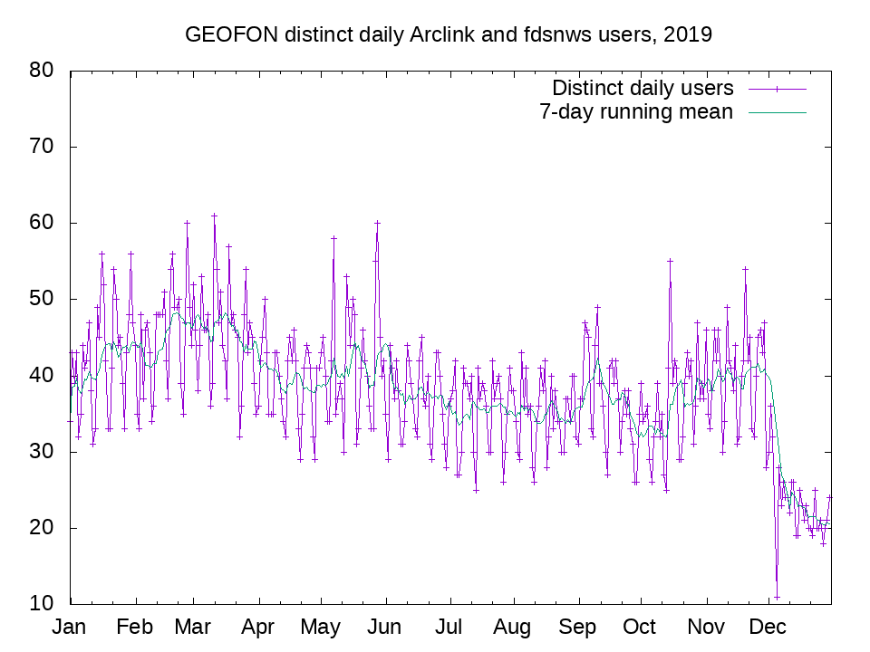
Fig. 4 Number of distinct user IDs provided for fdsnws and/or arclink on each day in 2019.
New networks (embargo period end reports or any other change)¶
At the end of the year the archive consisted of 137 networks and 4558 stations with 11 new temporary networks (listed below) added in 2019. Within the GDN project we invested substantial work in reviewing metadata, this includes GIPP grant number addded to network metadata and linked to the GIPP database from the network page.
- 2L_2015 El Hierro, Spain
- 3H_2014 LOFS
- 5K_2015 Wanrong
- 6C_2019 Myanmar
- X8_2018 SMARTIE1
- 8E_2018 Seismic sensing of hydraulic and sediment transport patterns below frozen subarctic river
- 4K_2017 Jasmund seismic cliff erosion monitoring network
- 6G_2017 Los Humeros
- 7A_2019 CaTeNA
- YG_2018 DESTRESS
- Z3_2015 German OBS component (GEOMAR) of Alparray
DOIs minted: 8 new temporary (XC_1998, 7A_2019, 6G_2017, X8_2018, 8E_2018, 3D_2014, 1T_2014, ZW_2010)
Networks Released
- ZE_2012
Real-time data export via seedlink:¶
The real-time data export via seedlink from the public Seedlink server at geofon.gfz-potsdam.de increased to ~160 TB/year with 300-350 continuous connections. The most requested network for real-time distribution is GE with 100+ TB followed by CX with ~10 TB and all other networks ranging between 10 TB and some MB.
Service uptime¶
| Service | Up | Down/Problem |
| WebDC | 99.810% | 0.190% |
| EIDA Master Table | 99.977% | 0.023% |
| fdsnws-dataselect | 98.951% | 1.049% |
| fdsnws-station | 99.864% | 0.136% |
| routingsvc | 99.989% | 0.011% |
| geofon-proc | 99.938% | 0.062% |
| geofon (ping) | 99.934% | 0.066% |
| geofon (Web pages) | 99.807% | 0.193% |
| geofon (eqinfo) | 99.765% | 0.235% |
| geofon (Seedlink) | 99.808% | 0.192% |
Note that the service uptime is measured by a Nagios instance running on a local machine. This means that times when the computer running Nagios was down, e.g., during a power out, would not be included in the analysis, and also times when the connection to the internet was broken would not necessarily be reported as down time. Even though technically this makes the report service uptime an upper bound estimate, no major episodes of either network or power outage are known to us, such that the numbers can probably be taken at face value.
Details of checks carried out:
- WebDC: check Arclink responds on port 18002 at webdc.eu.
- EIDA Master Table: check http://webdc.eu/arclink/table?group=eida is accessible.
- geofon-proc: MySQL (SeisComP db) available, and contains recent events.
- FDSN web services:
- check fdsnws-station at http://geofon.gfz-potsdam.de/fdsnws/station/1/version
- check fdsnws-dataselect at http://geofon.gfz-potsdam.de/fdsnws/dataselect/1/version
- routing service:
- geofon (ping): ping of geofon.gfz-potsdam.de
- geofon (web pages): visit the front page, http://geofon.gfz-potsdam.de/
- geofon (Seedlink): telnet geofon.gfz-potsdam.de 18000 succeeds.
- geofon (eqinfo): only to display http://geofon.gfz-potsdam.de/eqinfo/list.php,
GEOFON Rapid Earthquake Information¶
Published earthquake locations and moment tensor solutions¶
In total GEOFON published 4661 events and 905 moment tensor solutions via the web pages and other dissemination channels. Fig. 5 shows the geographic distribution of the published events and Fig. 6 the distribution of the moment tensors. The number of published events and moment tensors has slightly decreased with respect to the previous year.
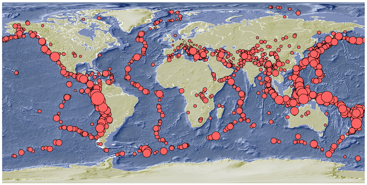
Fig. 5 Geographic distribution of the published events in 2019.
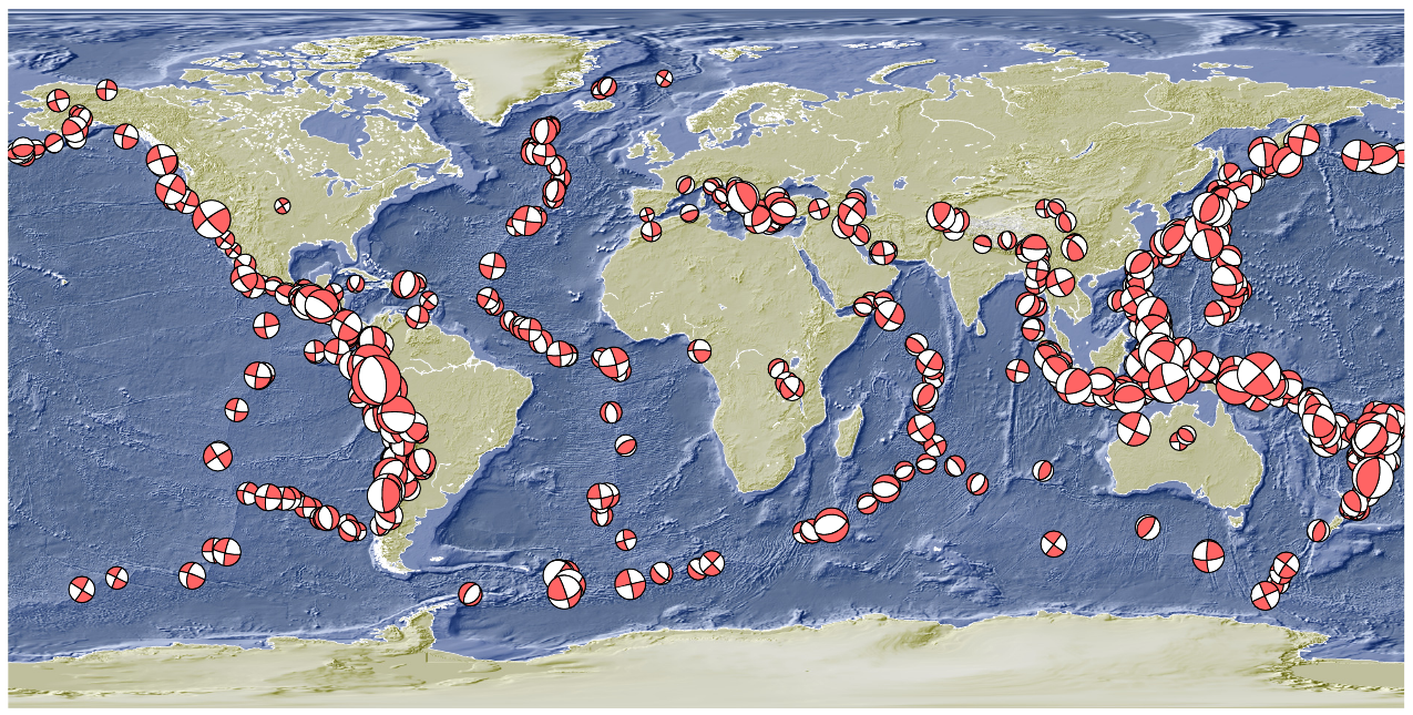
Fig. 6 Geographic distribution of the published moment tensor solutions in 2019.
| Mag | Num. events |
|---|---|
| \(\geq7.5\) | 3 |
| \(\geq6.5\) | 31 |
| \(\geq5.5\) | 394 |
| \(\geq4.5\) | 3702 |
| All | 4661 |
Removed “Fake” events are usually characterized by unfavorable azimuthal station coverage or even strongly clustered stations (IPOC, parts of Central Europe, Taiwan).
| Events | No MT | Has MT | Total |
|---|---|---|---|
| Published | x | x | 4661 |
| Status A | 1265 | x | 1265 |
| Status C | 1852 | 789 | 2640 |
| Status M | 636 | 116 | 752 |
| Removed | 4 | x | 4 |
Event notification delays are shown in Fig. 7 and Fig. 8 .
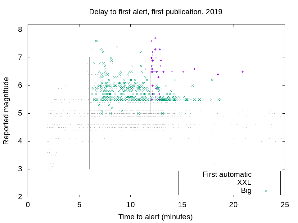
Fig. 7 Event publication (grey dots) and alert delay (big green and xxl red) vs. magnitude in 2019. Alert delay for GEOFON events in 2019 resulting in SMS alerts. Magnitude is the magnitude reported at the time of the alert. Also shown are events with only an automatic detection (status ‘A’).
| 2019 | xxl | big | Other | All classes |
|---|---|---|---|---|
| Total | 26 | 333 | 4302 | 4661 |
- The definitions of these alert types are:
- ‘xxl’ events are those with magnitude larger than 6.5 worldwide, or larger than 5.5 in or near Europe, or 5.0 in central Europe.
- ‘big’ events have magnitude above 5.5 in most of the world, or above 5.0 in the wider Europe/Mediterranean area and M>=4.5 in central Europe.
- the ‘Other’ category includes internal alerts and some regional notifications.
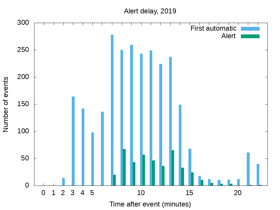
Fig. 8 GEOFON alert delay vs. first automatic publication.
GEOFON web server traffic¶
The number of distinct users connecting to geofon.gfz-potsdam.de is of typically ~30.000/day (Fig. 9). In distinct users we count both humans browsing through the pages as well as automatic usage including mobile apps with the latter being the dominant part (“Distinct” users are those with distinct IP address and User-Agent, on mobile devices IP may change and thus increase the numbers of counts). The traffic increase starting in coincidence with the release date of the new web site is not driven by actual users visiting the new pages though.
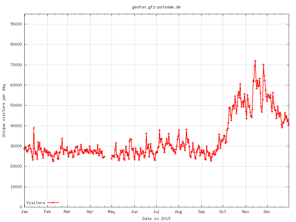
Fig. 9 Daily distinct users connecting to geofon.gfz-potsdam.de during 2019 (unique IP + user application which is dominated by automatic applications including mobile devices apps). Also shown is the magnitude of the largest event recorded on each day, when this exceeds 6.4. (The threshold for ‘xxl’ alerts is 6.5 in most of the world).
Ongoing cooperation with EMSC, ISC and Section 2.6¶
The assessment phase for crowdseeded fast locations using real-time picks exchanged with EMSC via HMB (httpmsgbus - software developed at GEOFON previously) has been completed and a joint paper published. The cooperation continues exchanging real-time arrival times as well as amplitudes upon request from EMSC for each crowdsourced detection.
Aiming at introducing a new service providing the Energy Magnitude in real-time we started testing, in cooperation with ISC and Section 2.6, the procedure proposed by Di Giacomo et al., 2008. We carried out the analysis of a data set including all events published in the GEOFON catalogue since 2011 with available moment tensor solution: 6106 Earthquakes; January 2011 - April 2020; 4.6<Mw<8.9; 2619 stations with BHZ channels (145 Open FDSN Networks), >3 millions records. The first results will be presented at the EGU annual meeting 2020.
Software development¶
Software development focused on preparing the new version of SeisComP 4.0.0 AGPL in cooperation with gempa GmbH for release in spring 2020. Another major activity has been the redesign of the web pages launched in October. The authentication service developed for EIDA has been successfully rolled out and used for the first time to access restricted data in EIDA via standard fdsn web services (AlpArray).
New GEOFON web pages¶
The new web pages went live in October and as shown in Fig. 9 we observed a traffic increase in coincidence with the release that is not related to the launch of the new web site though. We ivestigated the number of distinct users accessing the web pages during that period and this investigation confirms that most of the traffic came from automatic services (e.g. mobile apps and browsers). The new web pages have been optimised for mobile devices which is from where about half of our users are coming today. Together with the new web pages we launched also the GEOFON forum where the EQ alerts are posted.
SeisComP releases and usage (in cooperation with GEMPA)¶
The following SeisComP 3 releases were published in 2019: 2018.327.03 on January 7th 2019; 2018.327.13 on May 24th; 2018.327.15 on July 26th; 2018-327.21 on December 5th. 33 new non-commercial licenses were released in 2019 (total 555 at the end of 2019).
Impact, Outreach and Capacity Building¶
GEOFON data, services and products have been cited in ~700 papers published in ISI journals up to 2019 (~70 added in 2019). The full list of publications which explicitly acknowledged use of GEOFON products is available at https://geofon.gfz-potsdam.de/references/ and updated to 04.2020.
In 2019 GEOFON staff have presented at several conferences and contributed to several training events. In particular lectures and presentations about the usage of GEOFON products were given at the following events/venues:
- GFZ International Training Course, Potsdam, Germany.
- BMKG Jakarta, Indonesia.
- EGU Annual meeting, Vienna, Austria
- AG Seismologie annual meeting, Rastatt, Germany
- DGG Annual meeting, Munster, Germany
- ORFEUS/EPOS workshop, Grenoble, France
- SULU workshop OBS data, Potsdam, Germany
Additionally we were invited to two singular outreach events: “Erschütterungen” (Shaking in the society) at the “Literarische Colloquium Berlin” and at “WundeErde” a series of events hosted at the Italian Embassy in Berlin where we contributed with a seminar about Earthquake research and prevention.
GEOFON running projects¶
Geo-Data-Node (Ended in September)¶
- Description and tasks: GDN aims to improve data management practices at GFZ by fostering the implementation and practice of research data guidelines recently approved by GFZ. These guidelines are inspired by the FAIR data principles. Specifically the GEOFON team developed procedures to improve internal data policies. Relations between existing Persistent Identifiers have been reviewed for a better discovery of all resources related to a data set. In synergy with GIPP we have adopted Persistent Identifiers (PID) for instruments and jointly worked towards an API aiming at facilitating seismic metadata creation. This work has been coordinated internationally with the Research Data Alliance (RDA). Finally templates for the GFZ’s existing Scientific Technical Report series have been created to facilitate creation of STR to complement the data sets in archive.
- Duration: 2017-2019
- Funded by: BMBF
- PI: R.Bertelmann (GFZ)
- 12 PMs
EPOS-IP (Ended in September)¶
- Title: European Plate Observing System - Implementation Phase
- Description and tasks: EPOS-IP aims at creating a pan-European infrastructure for solid Earth science to support a safe and sustainable society. GEOFON and Section 2.6 at the GFZ are contributing to the Seismology Thematic Core Service (TCS). GEOFON is responsible for the coordination of the EIDA Next Generation development and contributes to strategic activities and governance. In particular for EIDA-NG the GEOFON team has developed the Routing Service, the Authorization system and updated the Web Interface to access data (WebDC3). In addition to the newly developed services GEOFON provided continuous update, improvements and new features in the SeisComP3 software package to facilitate data centre operations. Client side software independent of SeisComP3 has been developed (fdsnws_fetch) and more sophisticated clients are being developed. Coordination of the developments is ensured through the active participation of GEOFON managers and developers in the Management Board and Technical boards of EIDA.
- Duration: 2015-2019
- Funded by: European Commission
- Local PI at GFZ: J. Lauterjung
- PI: M. Cocco (INGV)
- 22 PMs
EOSC-Hub¶
- Title: Integrating and managing services for the European Open Science Cloud
- Description and tasks: The EOSC-Hub project creates the integration and management system of the future European Open Science Cloud that delivers a catalogue of services, software and data from the EGI Federation, EUDAT CDI, INDIGO-DataCloud and major research e-infrastructures. The Hub acts as a single contact point for researchers from scientific communities to discover, access, use and reuse a broad spectrum of resources for advanced data-driven research. GEOFON will be responsible for the tasks related to the Authentication and Authorization (AAI) system, as well as the Federated Data Life Cycle. In the case of AII, this extends from the initial collection of requirements, to definition of attributes roles and rules, to design and prototype development and finally to validation and assessment. In the case of the Federated Data Life Cycle, we will work on the design of automatic workflows for seismological data centres, including replication, persistent identifiers (PID) creation, and improvements in the data distribution. In a final stage, when services are already in production, we will focus on the training activities (e.g.: seminars, workshops) to foster the adoption of the services beyond seismology.
- Duration: 2018-2020
- Funded by: European Commission
- Local PI at GFZ: J. Quinteros
- PI: Y. Legre (EGI - Netherlands)
- 15 PMs
SERA¶
- Title: Seismology and Earthquake Engineering Research Infrastructure Alliance
- Description and tasks: The Seismology and Earthquake Engineering Research Infrastructure Alliance for Europe (SERA) aims to reduce the risk posed by natural and anthropogenic earthquakes based on innovative research and development projects. SERA will significantly improve the access to data, services and research infrastructures for scientists and other professionals. The GEOFON team, together with four EIDA node operators, will work towards consolidating the European Integrated Data Archive infrastructure with particular focus on facilitating the integration of new data and nodes as well as improving the user experience. We are specifically contributing to: (i) extend EIDA to integrate data types from OBS, induced seismicity observation networks, structural monitoring arrays, etc.; (ii) facilitate integration and long-term sustainability by providing extensive documentation, best practice guidelines for data acquisition and distribution as well as technical support; (iii) connect key scientists to the main operators of seismological networks to design the future generation of monitoring tools for Europe.
- Duration: 2017-2020
- Funded by: European Commission
- Local PI at GFZ: F. Cotton
- PI: D. Giardini (ETHZ - Switzerland)
- 5 PMs
EOSC-Pillar (Started in June)¶
- Title: EOSC-Pillar
- EOSC-Pillar is one of the European Open Science Cloud (EOSC) regional projects such as EOSC Nordic, NI4OS-Europe, EOSC Synergy and ExPaNDS. These projects aim to coordinate the efforts of the national and thematic initiatives in making a coherent contribution to EOSC, a virtual environment with open and seamless services for storage, management, analysis and re-use of research data, across borders and scientific disciplines. GFZ will work on a system describing Research Data Collections and enabling action on them (e.g. create, read, update, delete). Machine agents will be primary users of this type of systems, in which scalability and automation are important features. The system exposes a well defined API against which tools and services can be built across community boundaries. The Collection storage is agnostic and will be able to work with multiple backends. For Large-N deployments and Distributed Acoustic Sensing (DAS) we will evaluate and review the currently used metadata and data formats and investigate other options. For instance, consider alternative formats for large volumes of data suitable also for ingestion at HPC facilities e.g. PH5 (HDF5 format) possibly adding a new output format to the current FDSN services while preserving the miniSEED format output. Consider a revision of the metadata to accommodate non-conventional seismic sensors and in particular to the DAS applications with the description of virtual sensors along the fibre-optic cables. Also evaluate the impact in storage and extra computational resources needed for our service in case of adoption of the new formats.
- Duration: 2019-2022
- Funded by: European Commission
- Local PI at GFZ: J. Quinteros
- PI: P. Ruggeri (GARR - Italy)
- 36 PMs
RISE (Started in September)¶
- Title: Real-time earthquake risk reduction for a ReSilient Europe
- The key objective of RISE is to advance real-time earthquake risk reduction capabilities for a resilient Europe. With an improved scientific understanding and the use of emerging technologies human and economic losses shall be further reduced. New measures are needed to compliment present efforts in implementing building codes and retrofitting existing structures. GEOFON (and its other 3 partners from ORFEUS) will investigate the challenges posed to major seismological data centers - like the ORFEUS Data Center (ODC) and other primary EIDA nodes (GFZ, INGV, ETHZ) – by the emerging methodologies and technologies in real-time observational seismology. Examples include: (i) very large density arrays of ‘traditional’ seismic instrumentation (link with Task 2.4); (ii) low cost MEMS acceleration sensor, largely used for dense structural monitoring and the emerging EEW applications through their integration in standard smartphones; (iii) optical fibres and distributed acoustic sensing, technologies with the potential to mimic a seismic observatory managing billions of sensors.
- Duration: 2019-2022
- Funded by: European Commission
- Local PI at GFZ: D. Schorlemmer
- PI: S. Wiemer (ETHZ - Switzerland)
- 6 PMs
Publications by GEOFON staff¶
Bindi, D., Zaccarelli, R., Strollo, A., Di Giacomo, G. (2019): Harmonized local magnitude attenuation function for Europe using the European Integrated Data Archive (EIDA). - Geophysical Journal International, 218, 1, 519-533. https://doi.org/10.1093/gji/ggz178
Steed, R. J., Fuenzalida, A., Bossu, R., Bondár, I., Heinloo, A., Dupont, A., Saul, J., Strollo, A. (2019): Crowdsourcing triggers rapid, reliable earthquake locations. - Science Advances, 5, 4, eaau9824. https://doi.org/10.1126/sciadv.aau9824
Zaccarelli, R., Bindi, D., Strollo, A., Quinteros, J., Cotton, F. (2019): Stream2segment: An Open‐Source Tool for Downloading, Processing, and Visualizing Massive Event‐Based Seismic Waveform Datasets. - Seismological Research Letters, 90, 5, 2028-2038. https://doi.org/10.1785/0220180314
Walter, T. R., Haghshenas Haghighi, M., Schneider, F. M., Coppola, D., Motagh, M., Saul, J., Babeyko, A. Y., Dahm, T., Troll, V. R., Tilmann, F., Heimann, S., Valade, S., Triyono, R., Khomarudin, R., Kartadinata, N., Laiolo, M., Massimetti, F., Gaebler, P. (2019): Complex hazard cascade culminating in the Anak Krakatau sector collapse. - Nature Communications, 10, 4339. https://doi.org/10.1038/s41467-019-12284-5
GEOFON Team (Human Resources)¶
| Name | GE Net. | GE DC | EQ info | GE op. | Soft. Dev. | Outreach | Funding |
|---|---|---|---|---|---|---|---|
| Angelo Strollo | x | x | x | x | x | GFZ | |
| Thomas Zieke | x | GFZ | |||||
| Karl-Heinz Jäckel[*] | x | GFZ | |||||
| Javier Quinteros | x | x | x | EOSC-Hub/GDN/SERA | |||
| Susanne Hemmmleb | x | GFZ | |||||
| Laura Hillmann[†] | x | BMKG-GEMPA/GFZ | |||||
| Riccardo Zaccarelli[*] | x | x | EPOS-IP/GFZ | ||||
| Joachim Saul[*] | x | x | x | x | GFZ | ||
| Andres Heinloo | x | x | x | x | x | GFZ | |
| Peter Evans | x | x | x | x | x | x | GFZ |
[*] Not working full time for GEOFON [†] Since July 2019
GEOFON Advisory Committee Members¶
Dr. Florian Haslinger, Chair, ETH Zurich, Zurich,CH
Dr. Christian Bönnemann, BGR Hannover, D (until August 2019)
Dr. Klaus Stammler, BGR Hannover, D (since September 2019)
Prof. Dr. Wolfgang Friederich, RU Bochum, Bochum, D
Prof. Dr. Thomas Meier, CAU Kiel, D
Prof. Dr. Max Wyss International Centre for Earth Simulation, Geneva, CH
Dr. Jan Zednik, GFU Prague, CZ
Acknowledgements¶
We acknowledge partners co-operating GEOFON stations and data providers enabling us to create the so called GEOFON Extended Virtual Network (GEVN) used for the rapid earthquake information. We are also thankful to users and in particular to our advisory committee for their valuable feedbacks. Thanks to Rens Hofman (FU Berlin) who kindly joined the mission to Summit (Greenland), to provide support during the moving of the seismic vault of the SUMG station. We would like to finally acknowledge also our former GEOFON head Winfried Hanka for his kind support and suggestions when asked.
References¶
Di Giacomo, D., Grosser, H., Parolai, S., Bormann, P., and Wang, R. (2008), Rapid determination of Me for strong to great shallow earthquakes, Geophys. Res. Lett., 35, L10308, doi:10.1029/2008GL033505.
McNamara, Daniel & Buland, Raymond. (2004). Ambient Noise Levels in the Continental United States. Bulletin of the Seismological Society of America. 94. 1517-1527. 10.1785/012003001.
Appendices¶
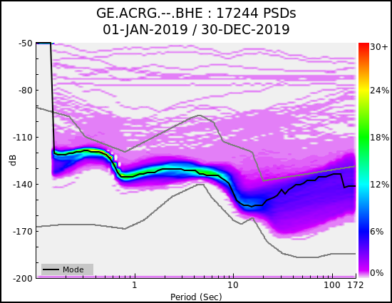
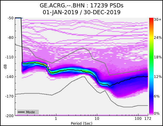
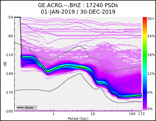
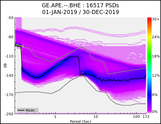
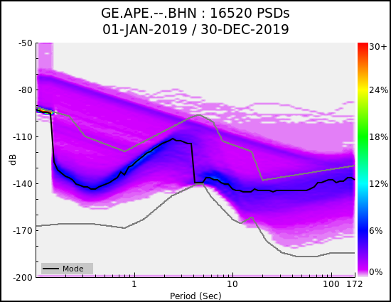
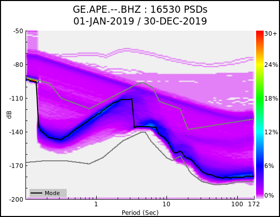
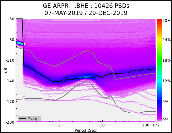
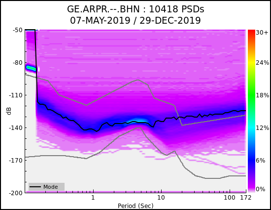
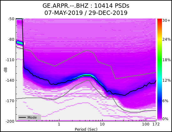
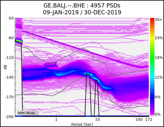
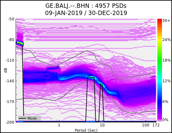
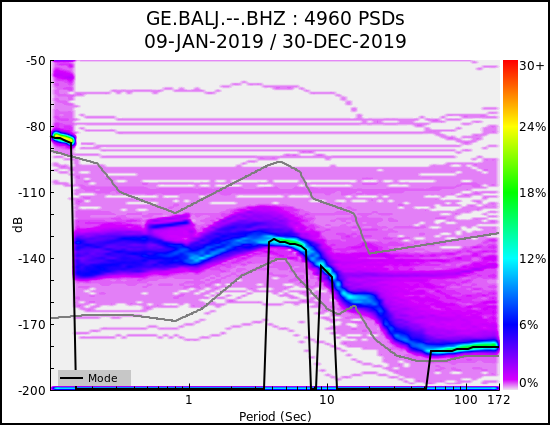
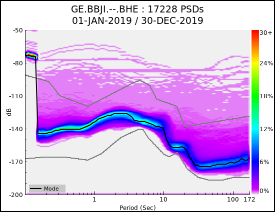
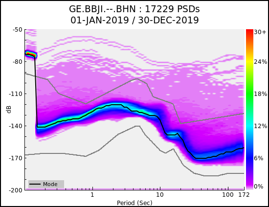
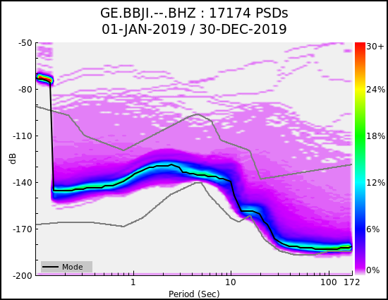
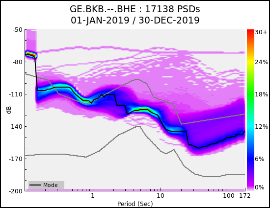
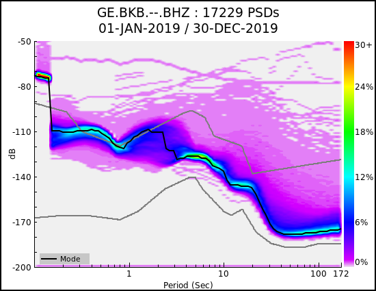
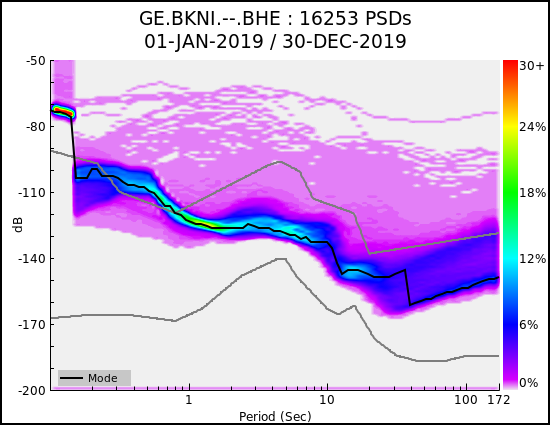
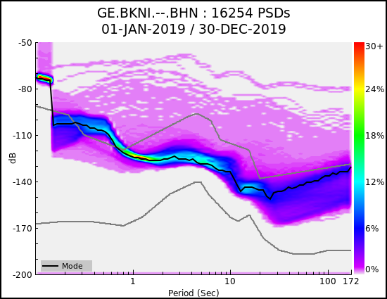
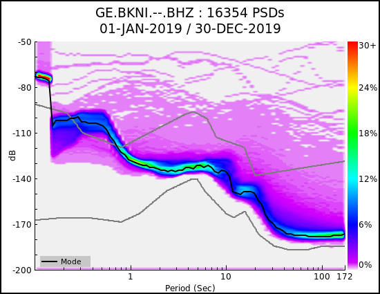
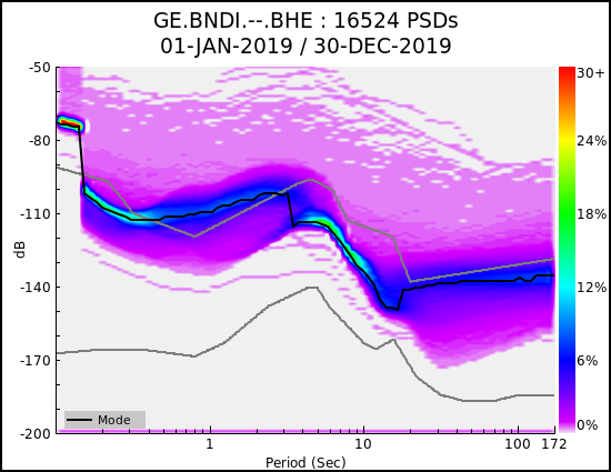
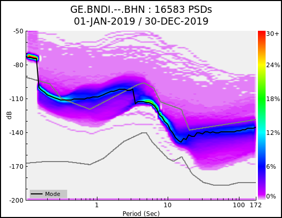
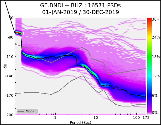
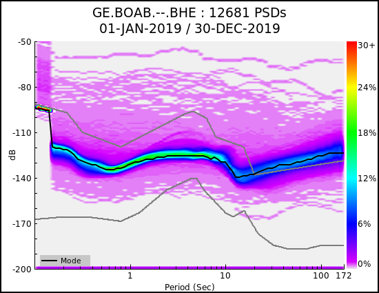
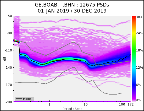
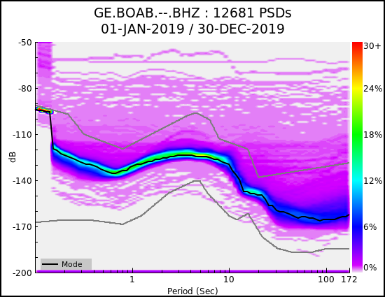
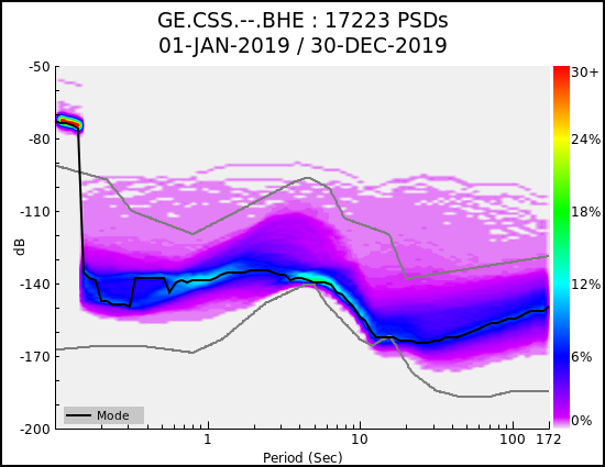
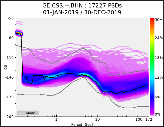
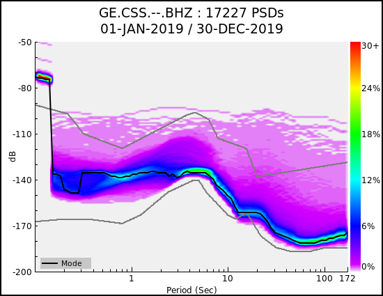
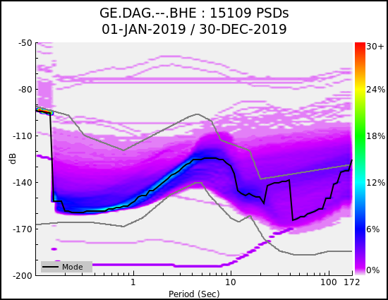
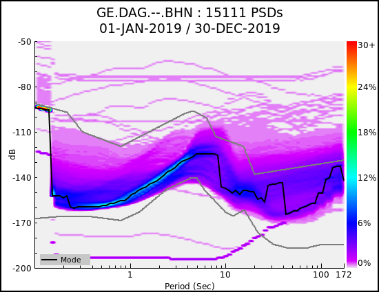
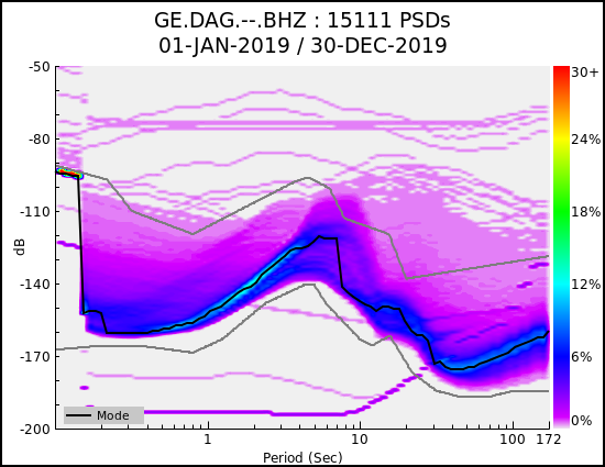
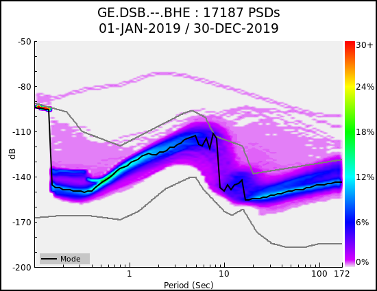
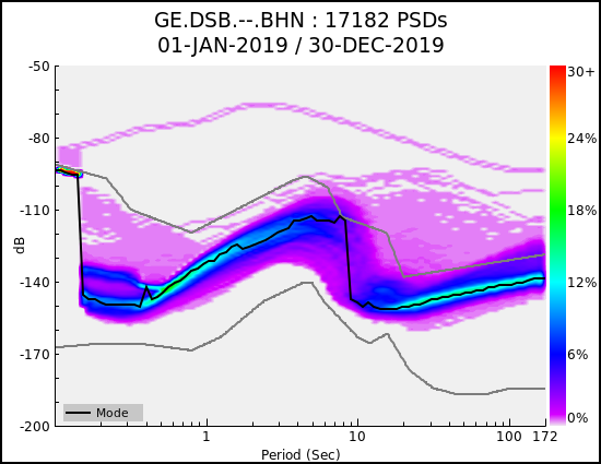
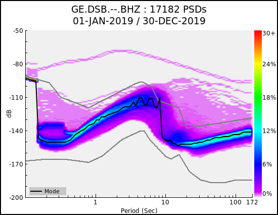
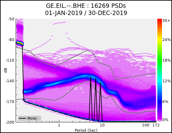
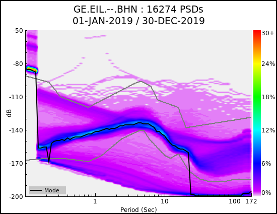
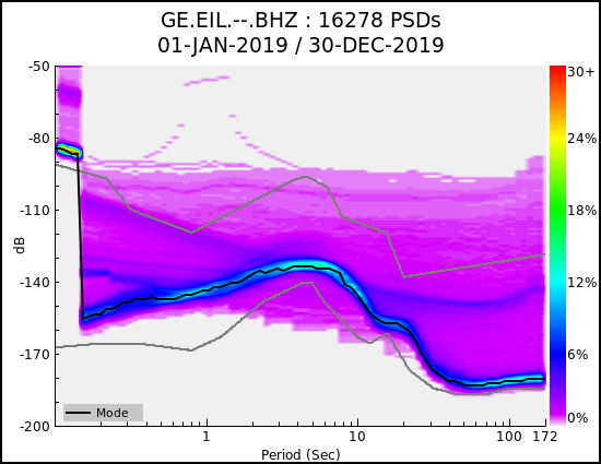
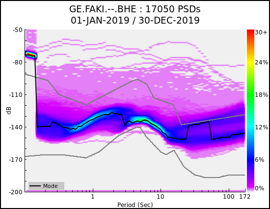
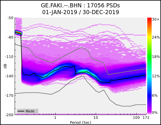
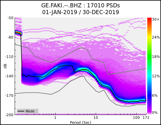
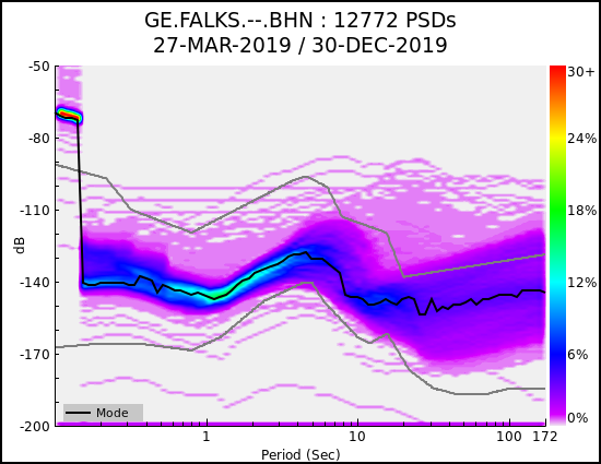
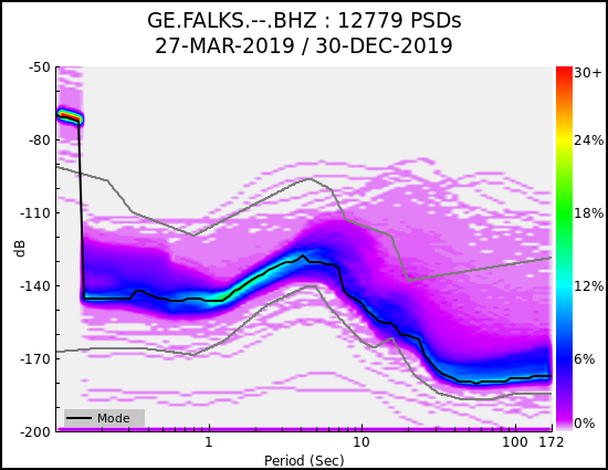
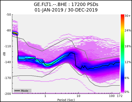
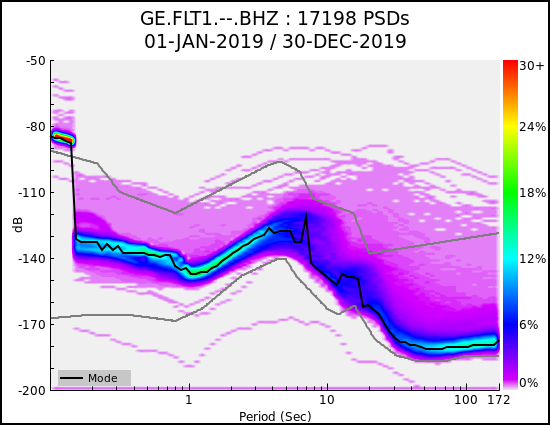
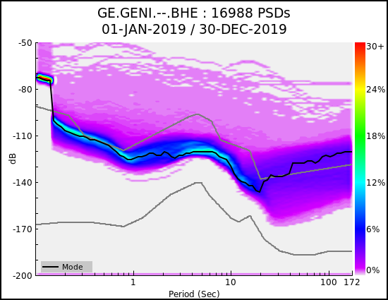
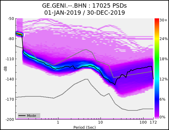
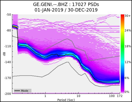
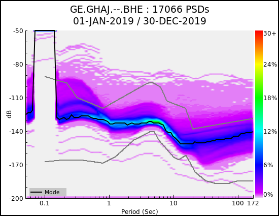
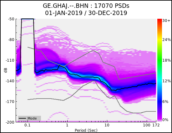
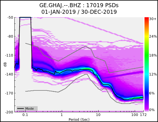
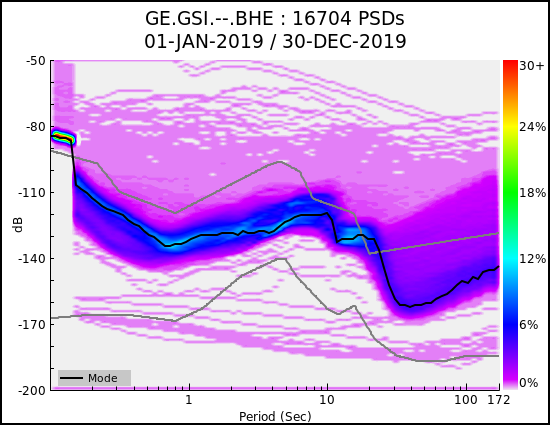
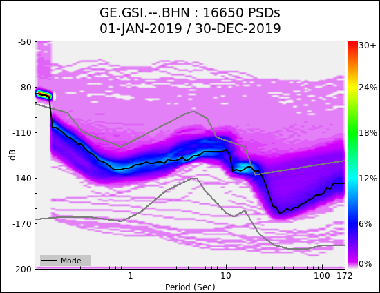
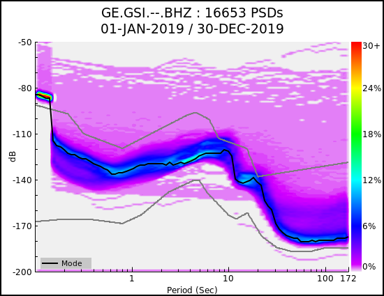
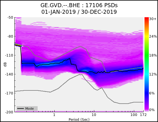
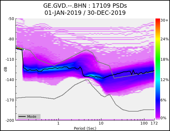
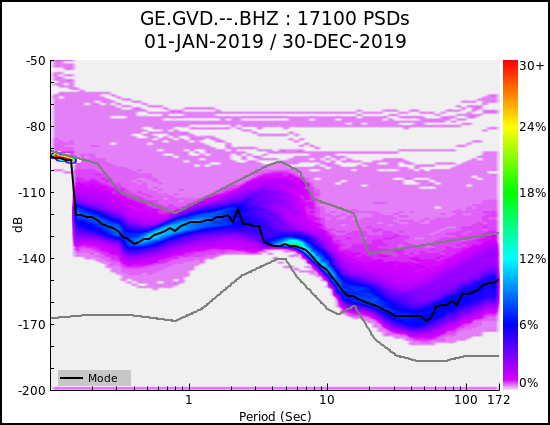
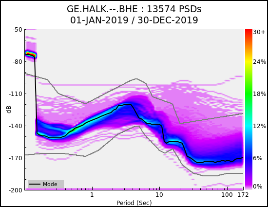
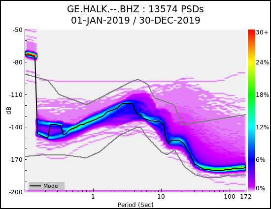
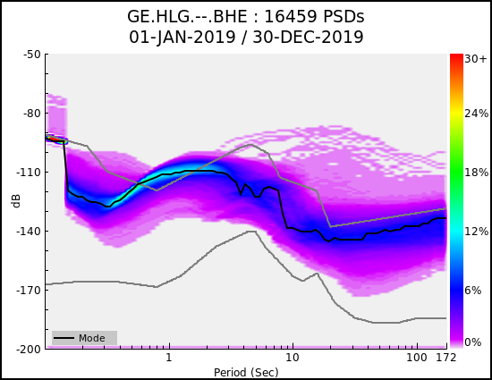
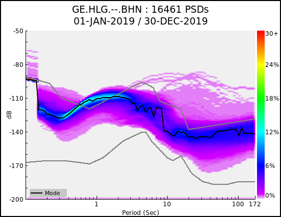
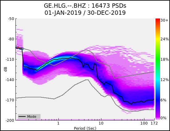
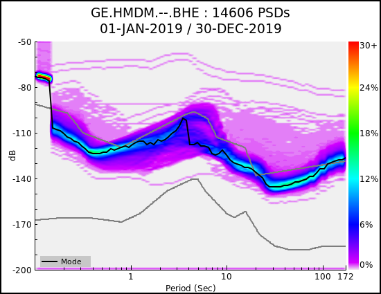
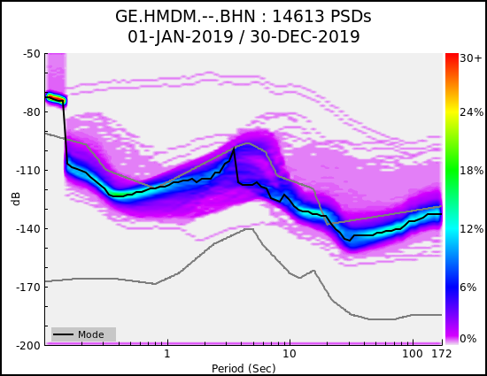
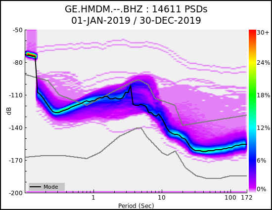
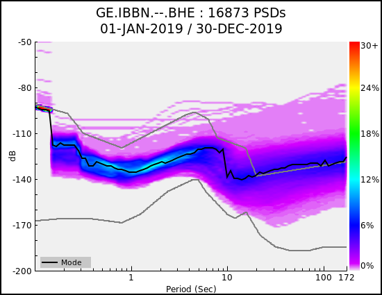
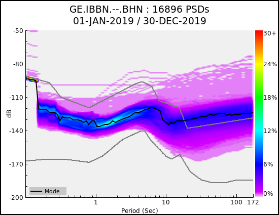
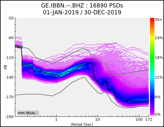
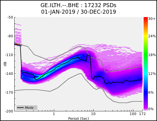
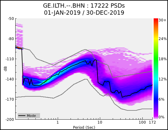
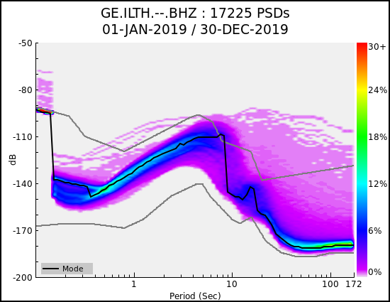
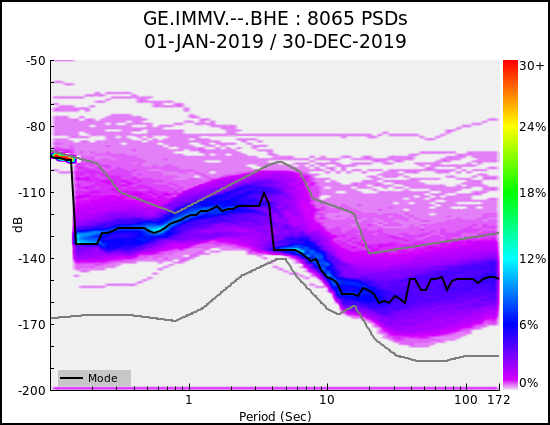
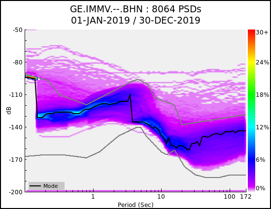
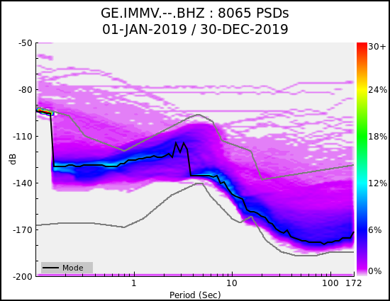
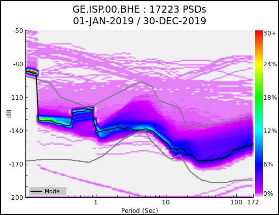
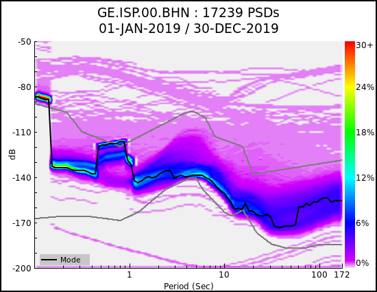
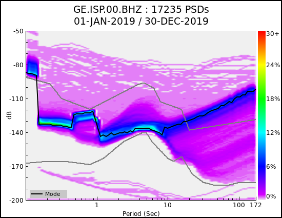
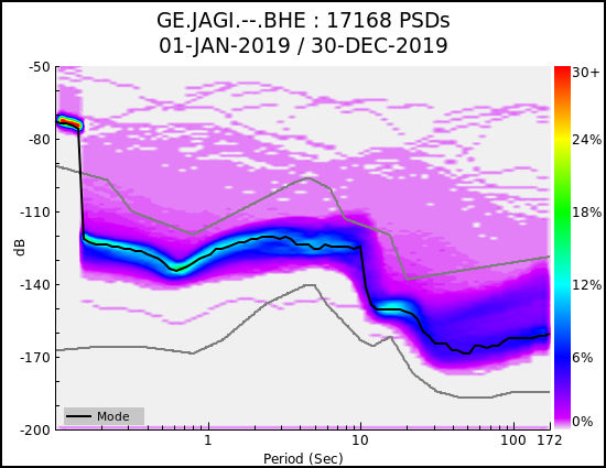
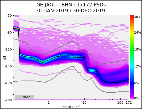
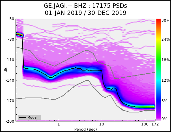
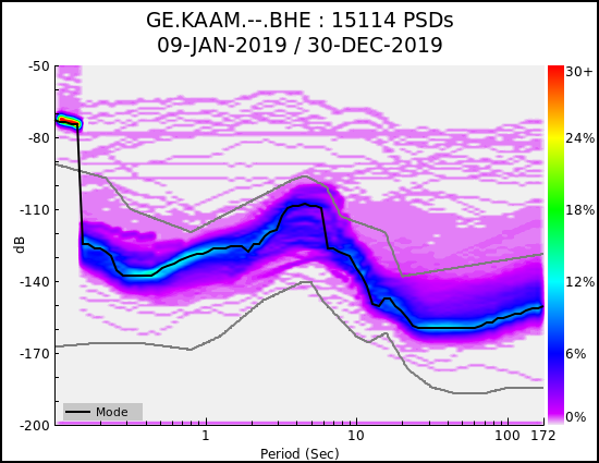
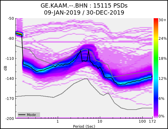
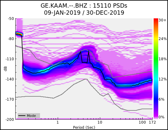
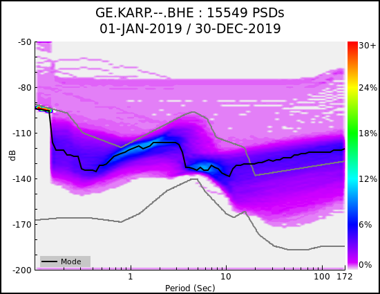
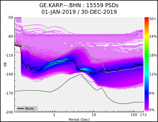
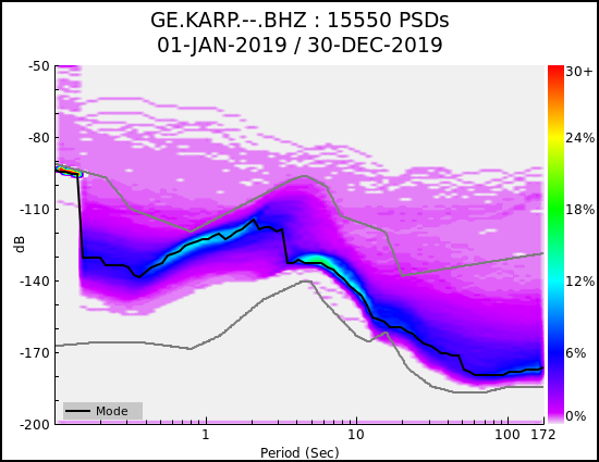
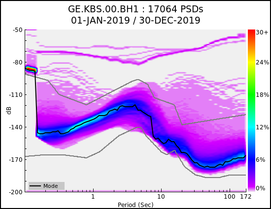
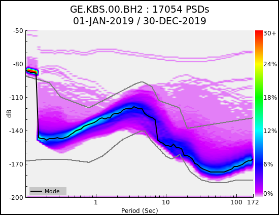
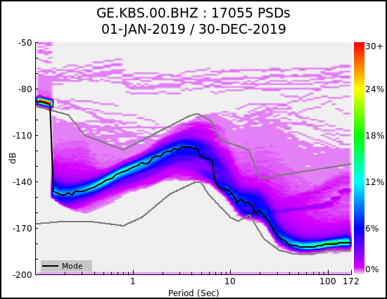
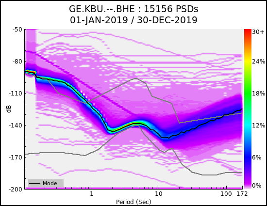
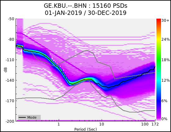
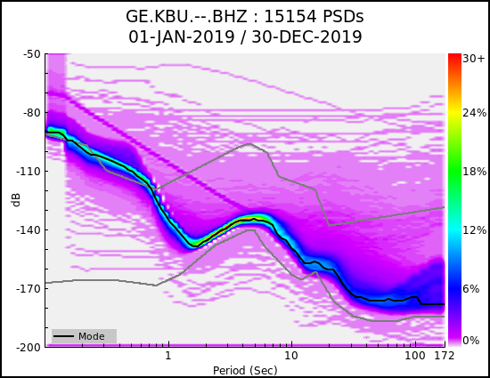
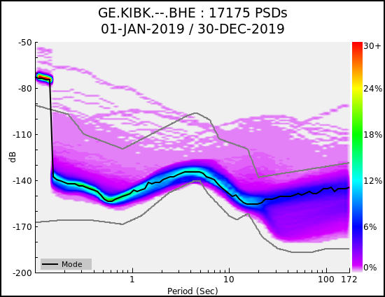
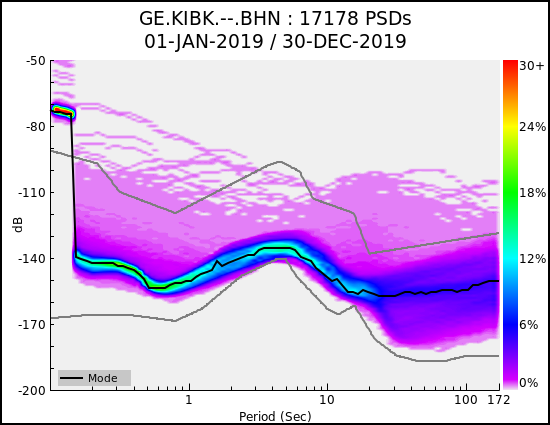
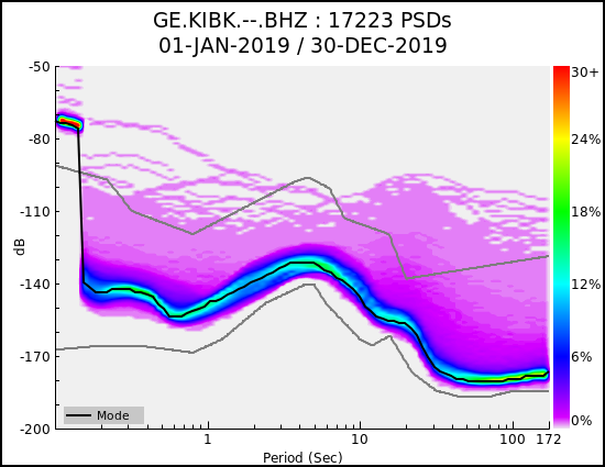
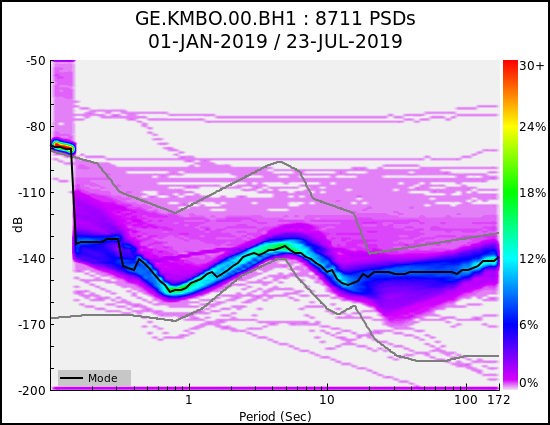
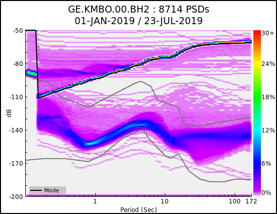
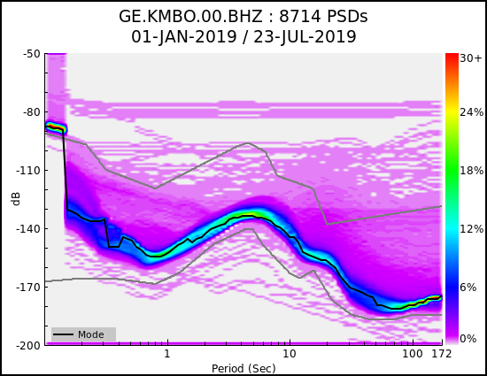
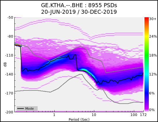
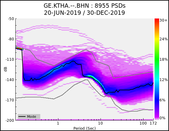
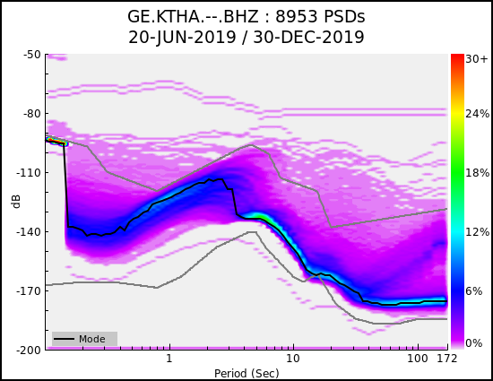
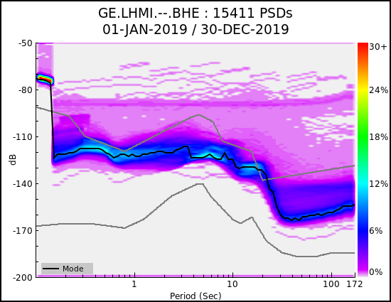
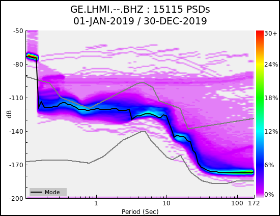
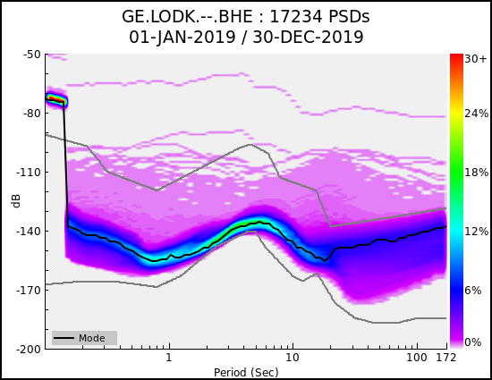
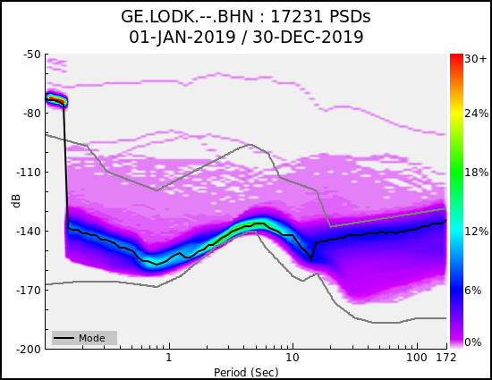
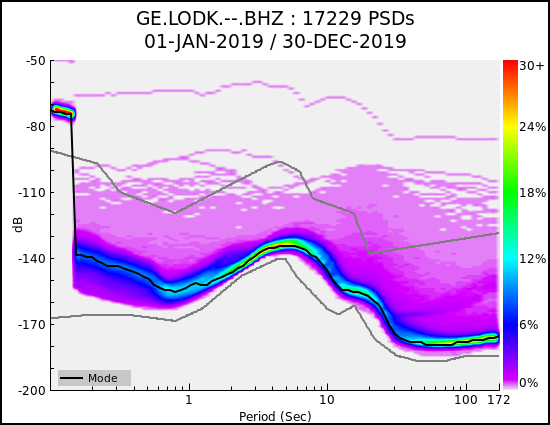
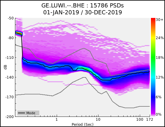
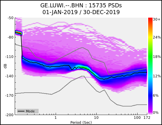
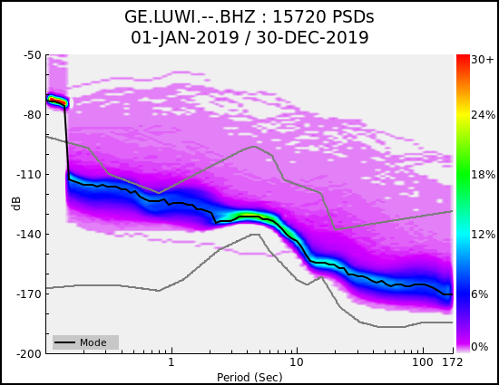
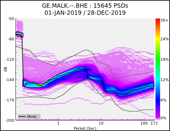
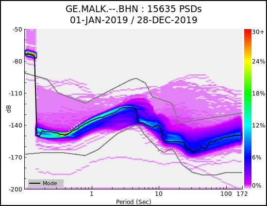
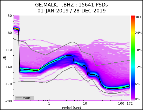
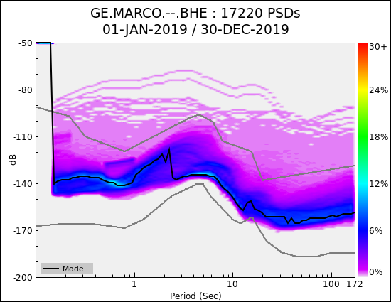
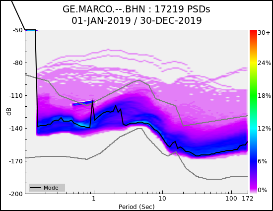
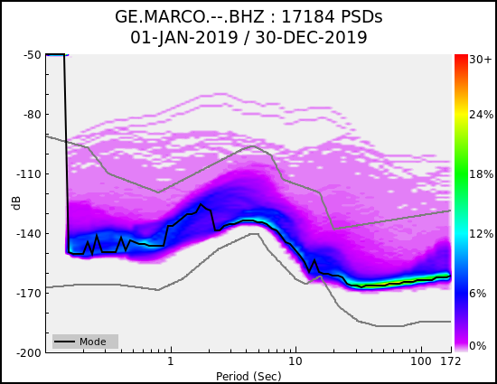
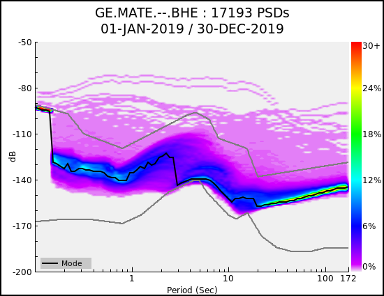
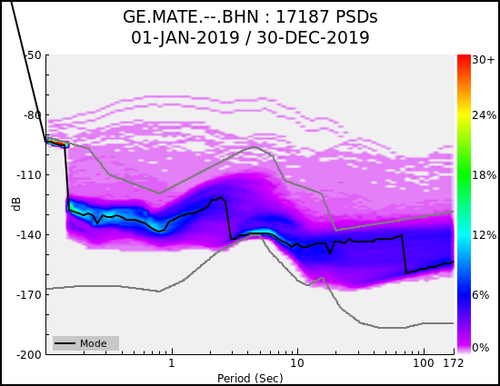
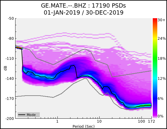
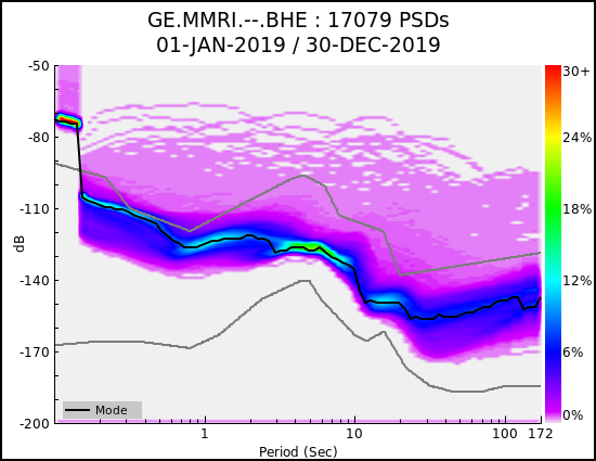
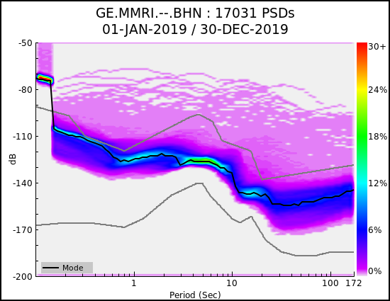
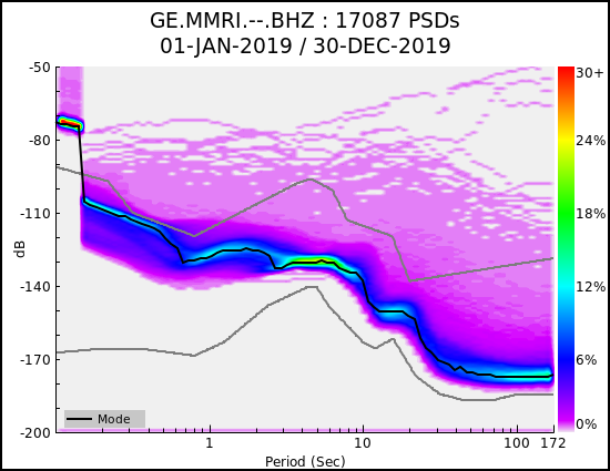
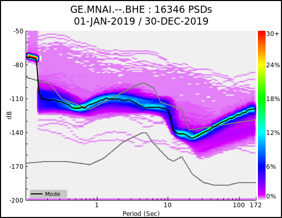
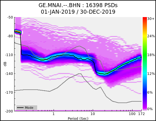
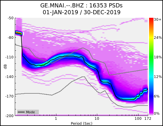
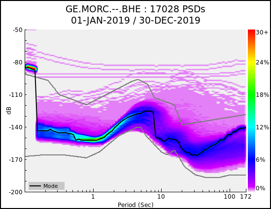
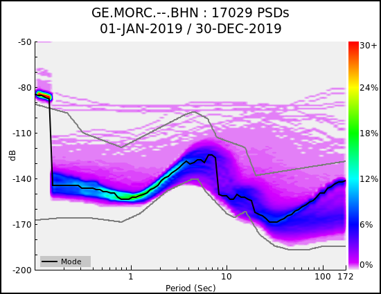
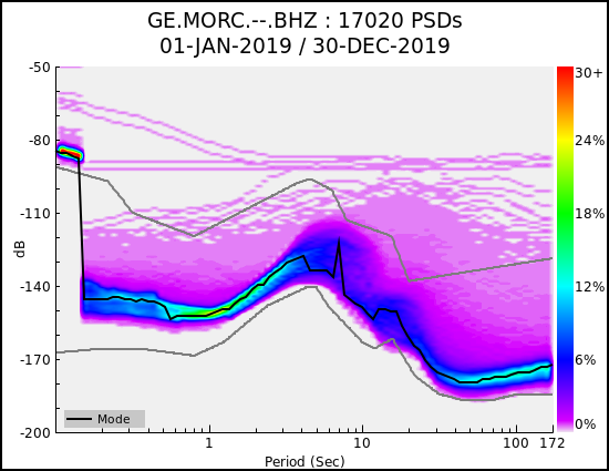
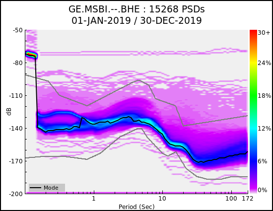
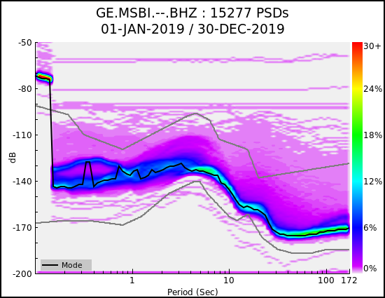
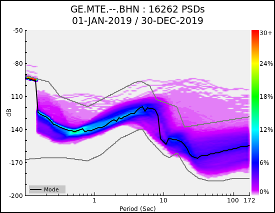
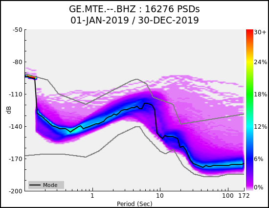
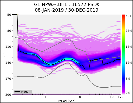
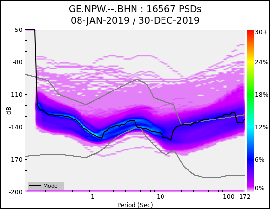
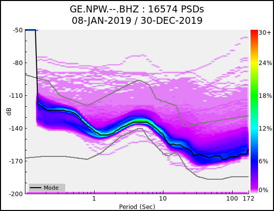
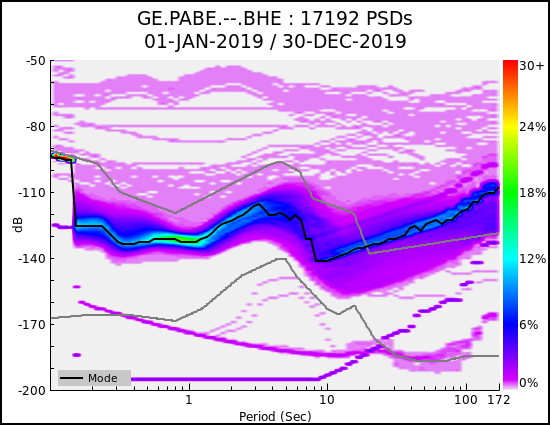
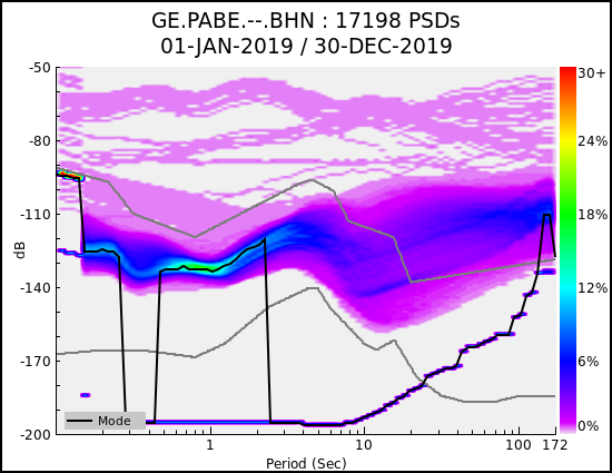
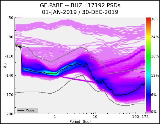
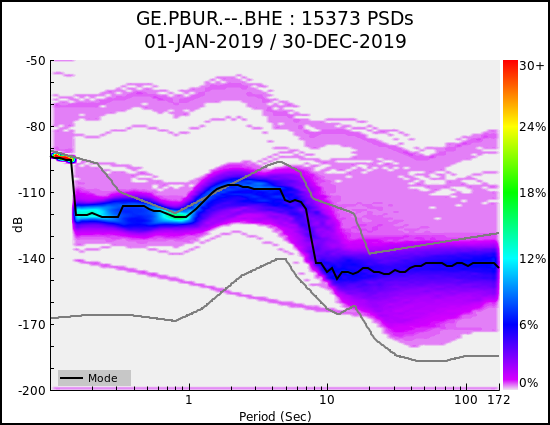
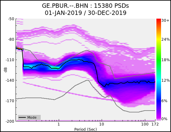
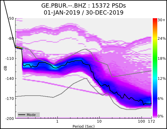
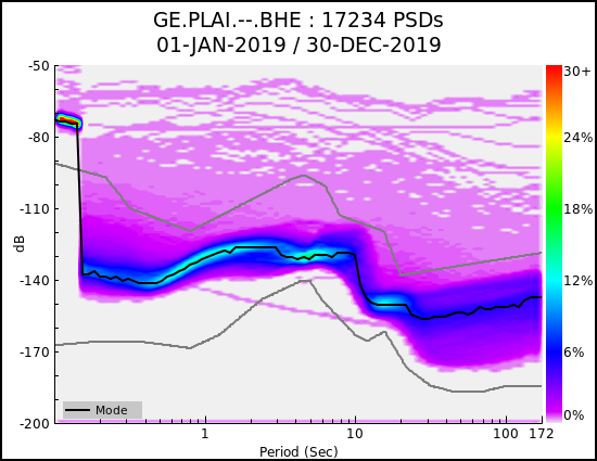
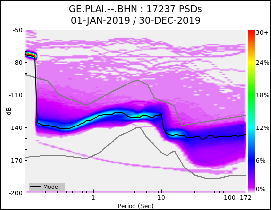
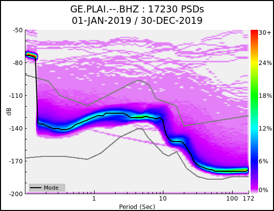
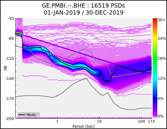
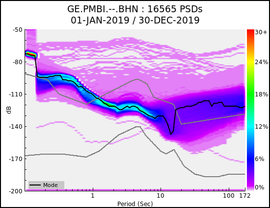
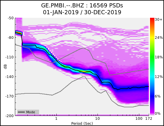
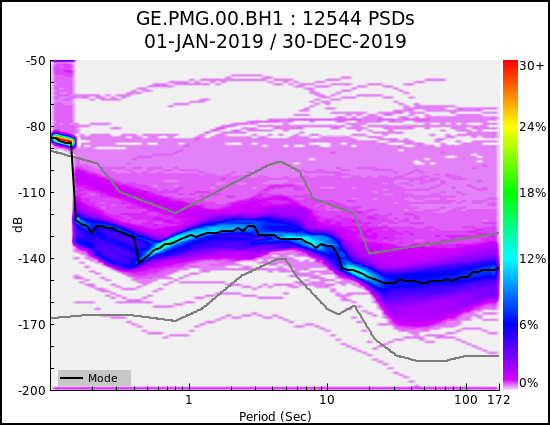
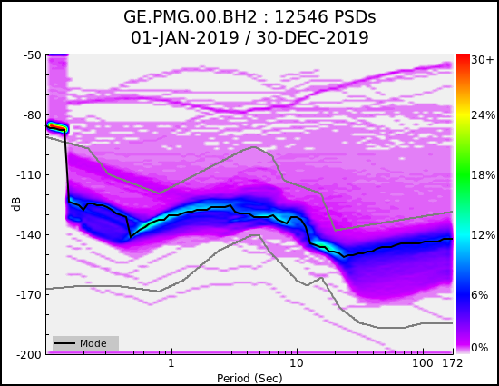
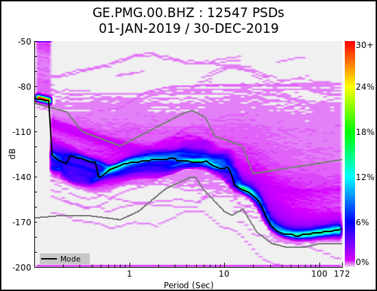
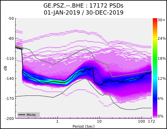
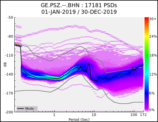
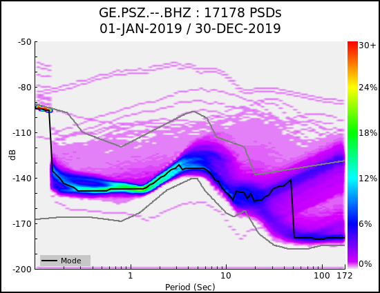
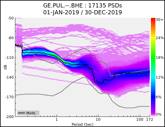
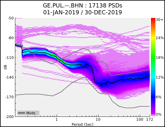
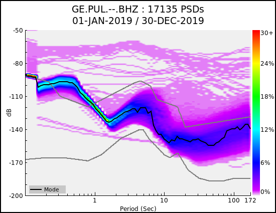
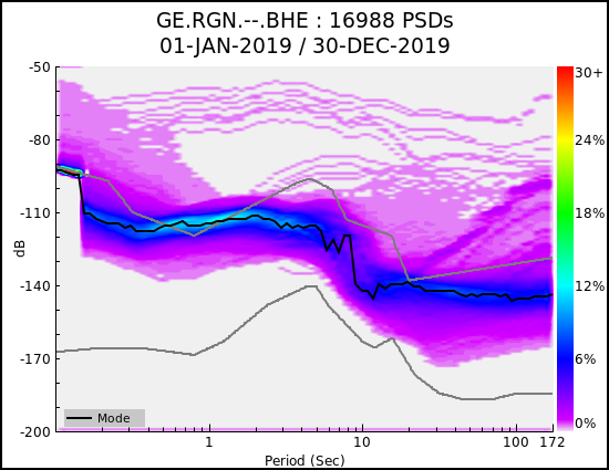
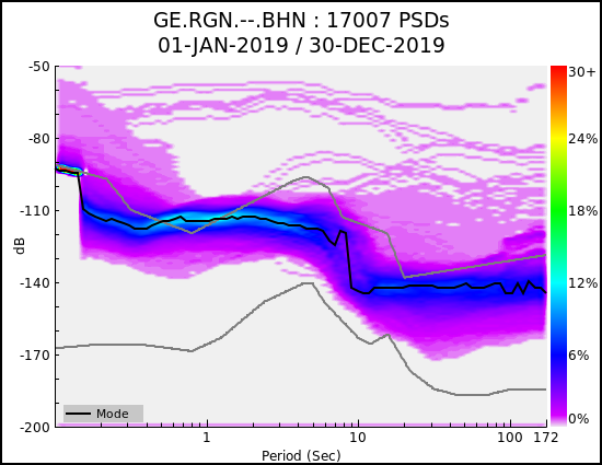
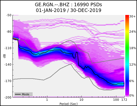
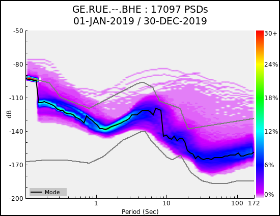
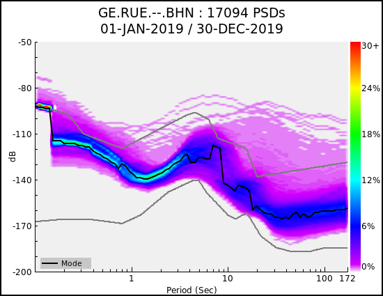
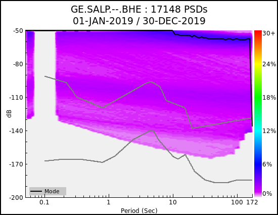
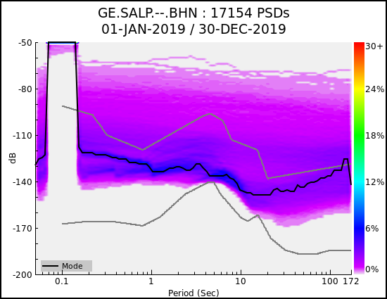
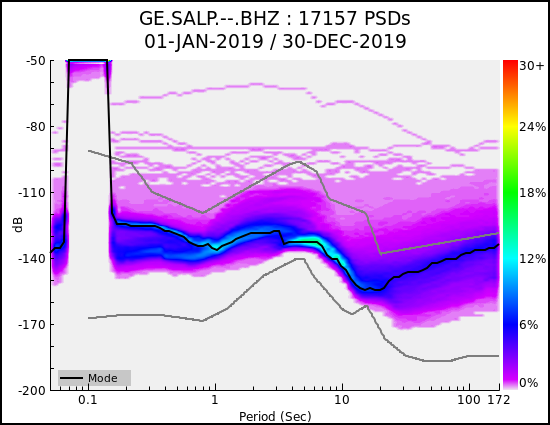
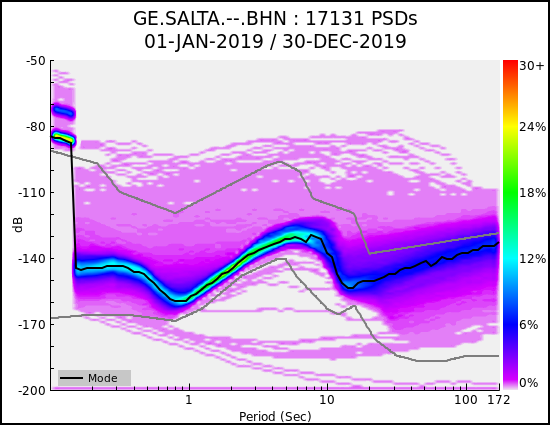
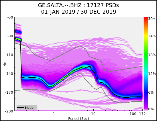
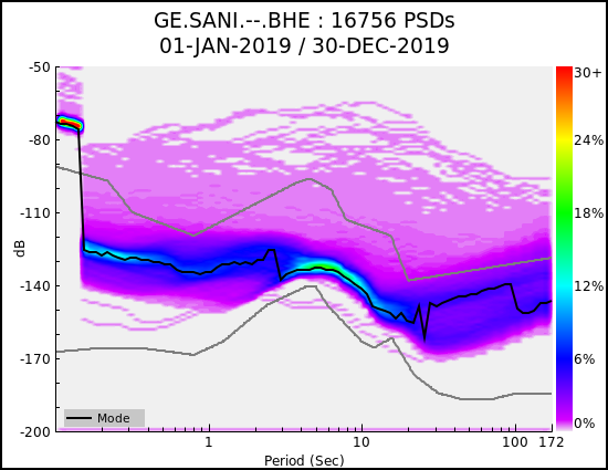
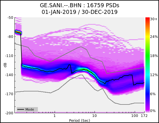
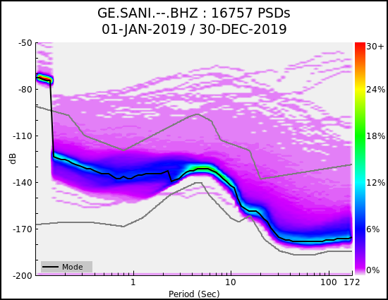
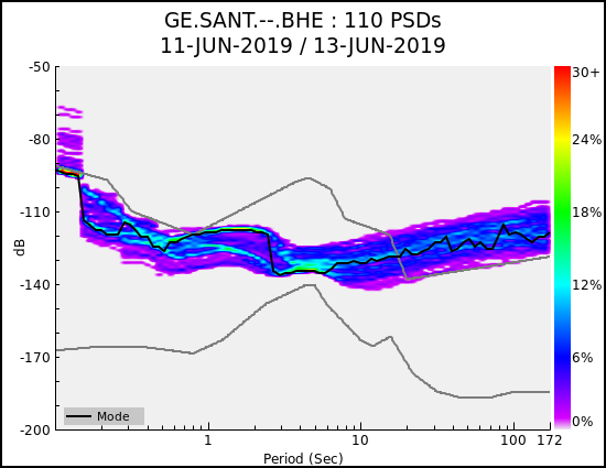
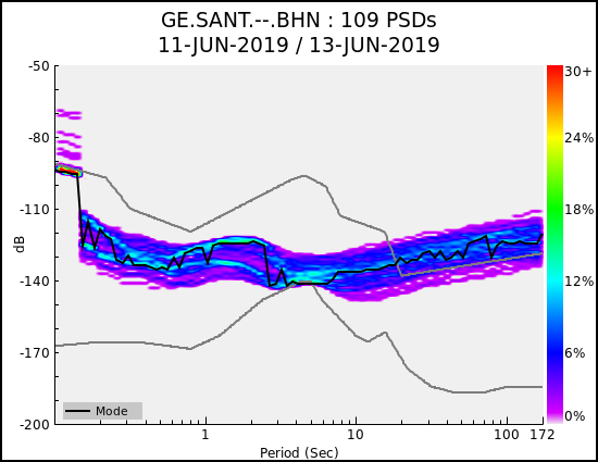
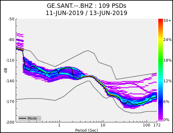
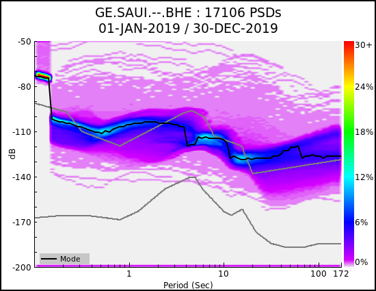
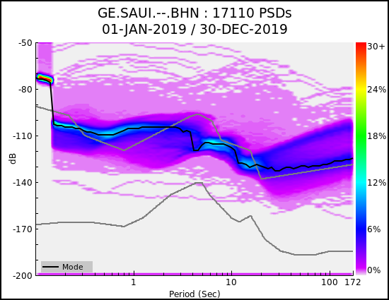
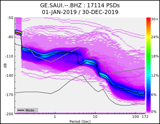
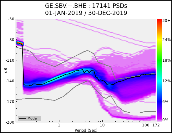
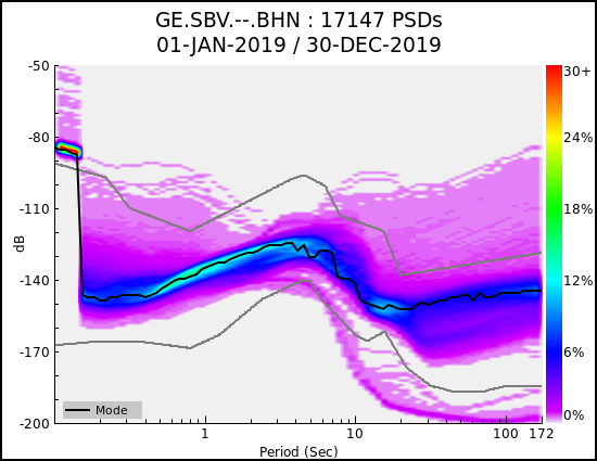
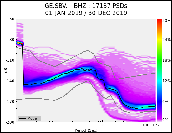
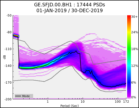
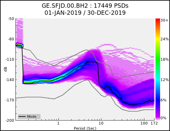
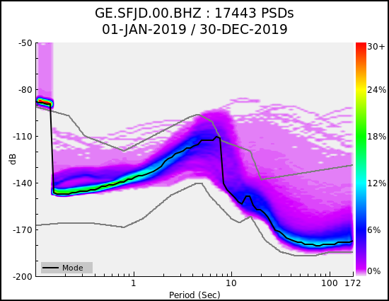
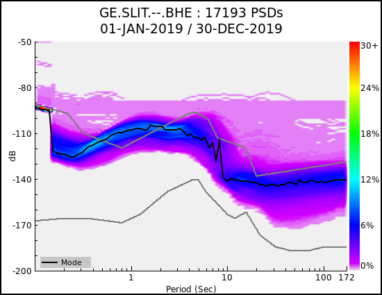
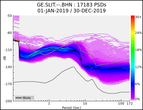
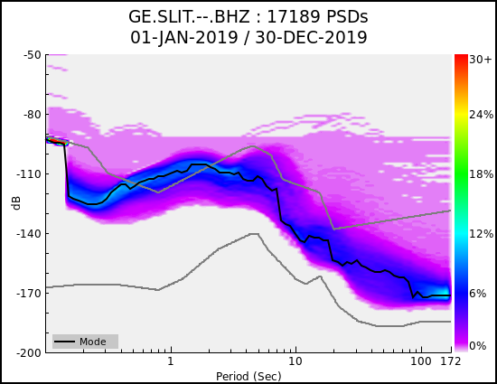
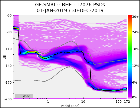
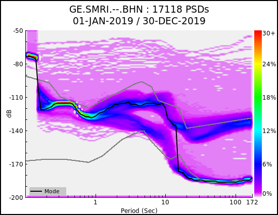
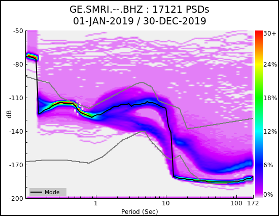
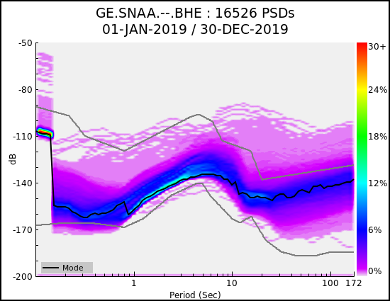
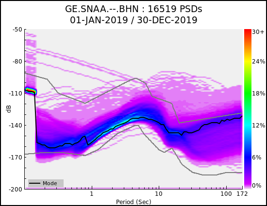
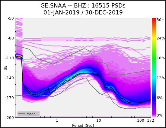
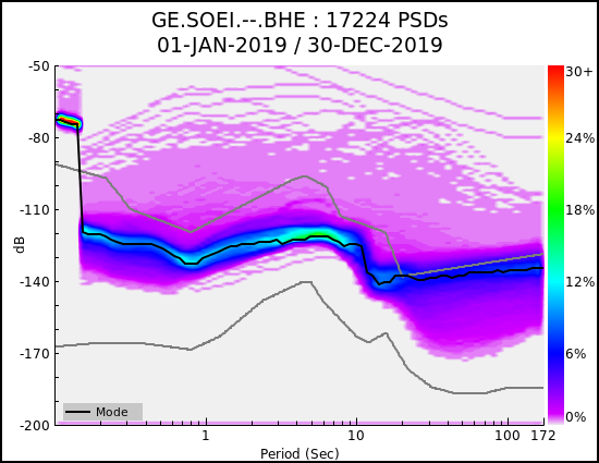
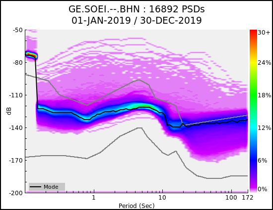
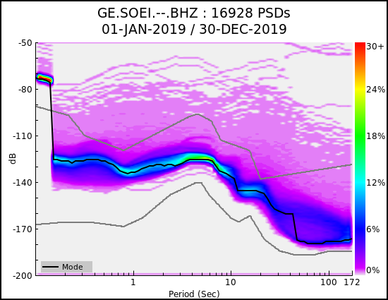
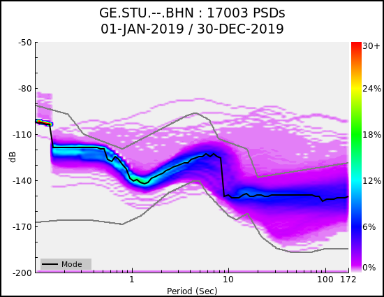
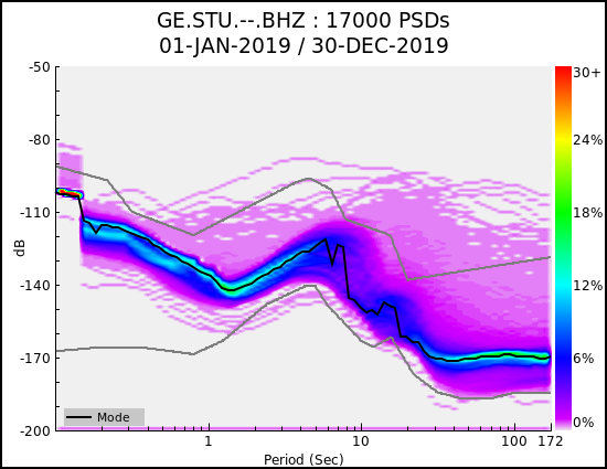
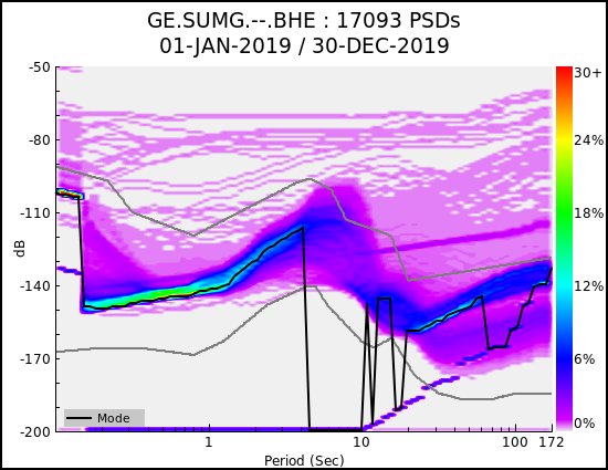
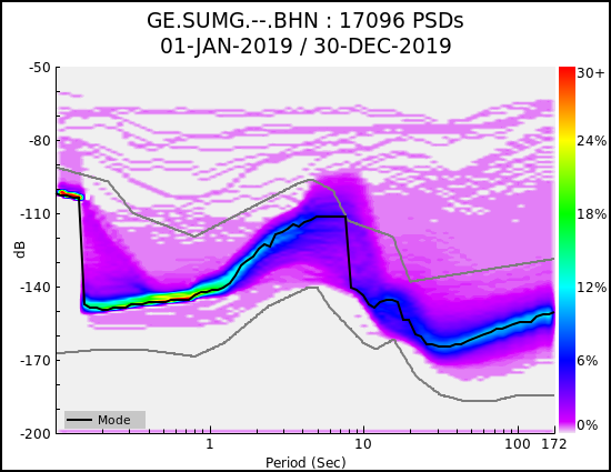
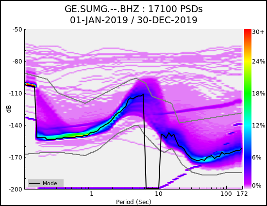
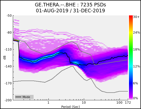
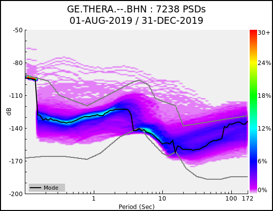
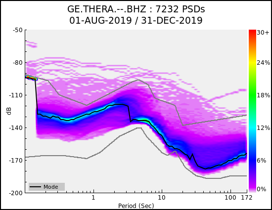
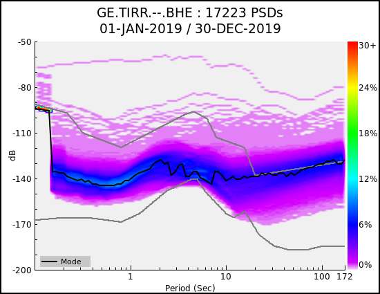
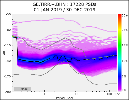
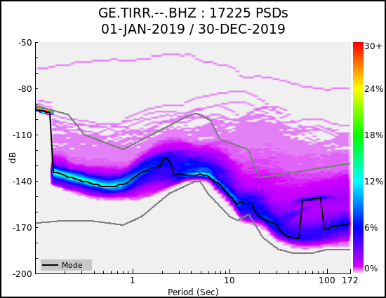
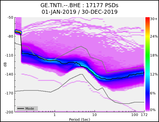
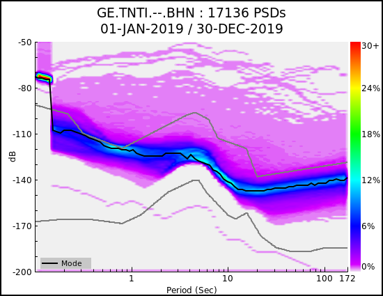
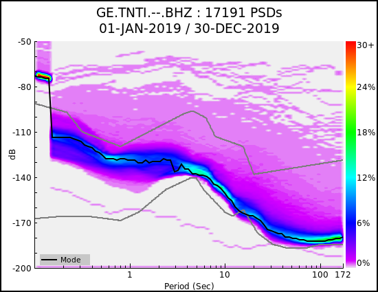
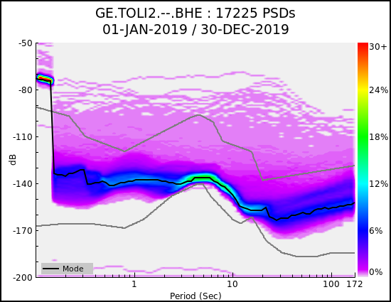
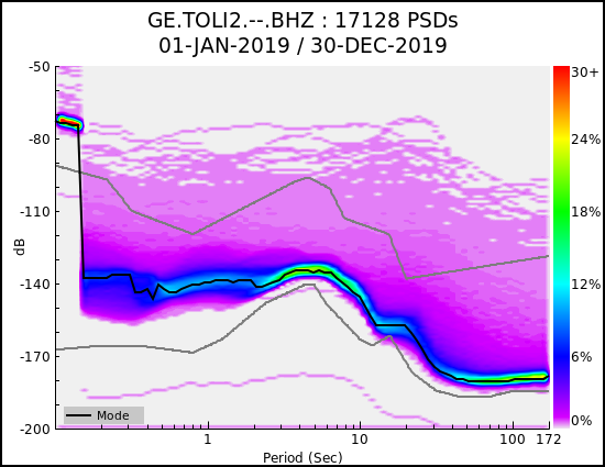
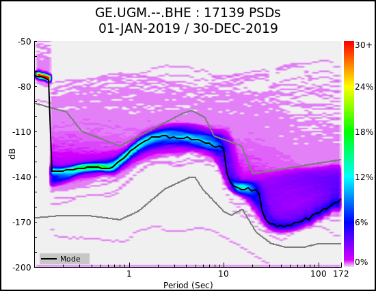
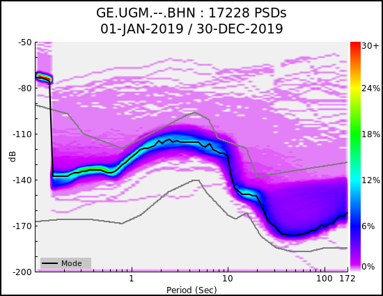
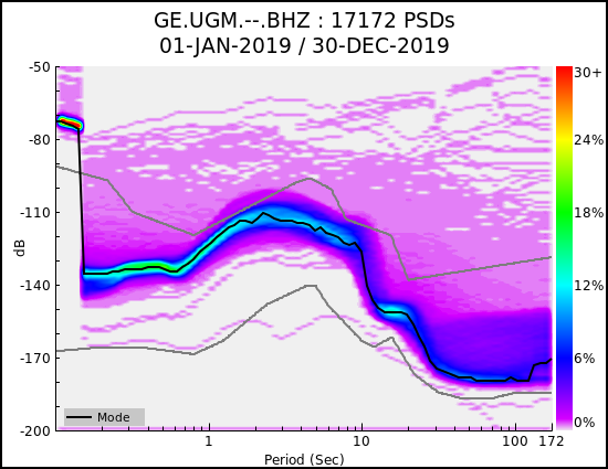
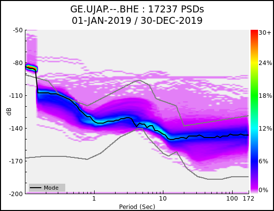
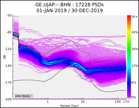
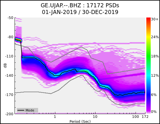
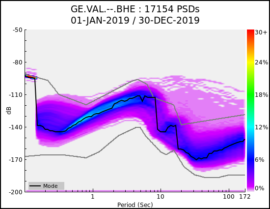
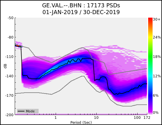
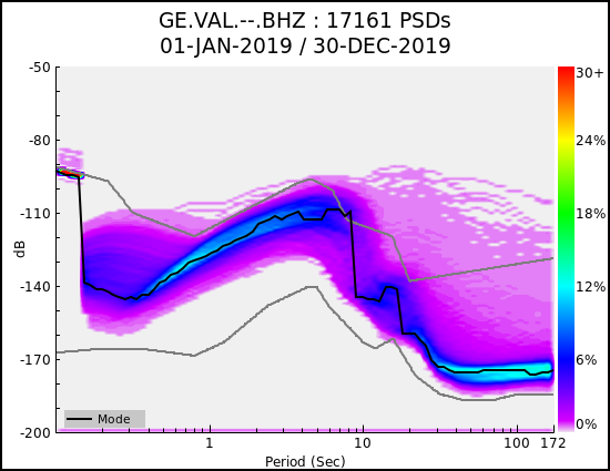
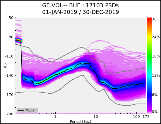
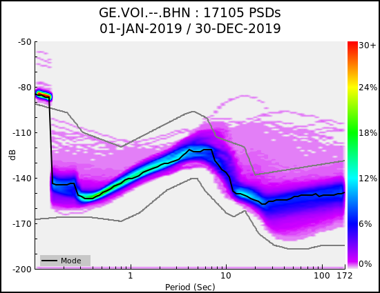
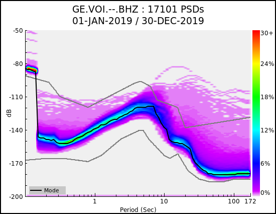
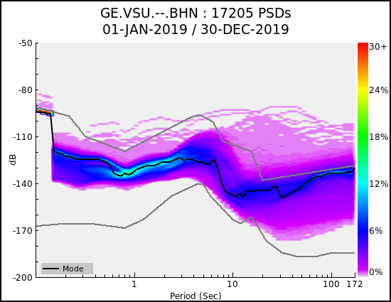
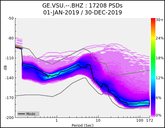
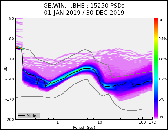
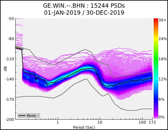
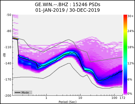
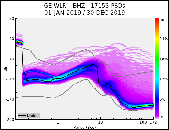
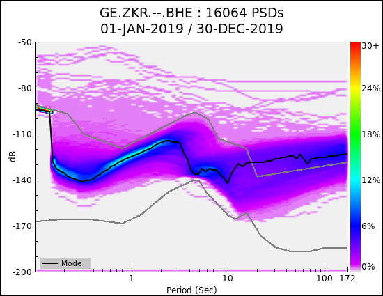
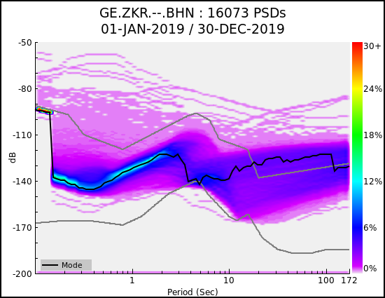
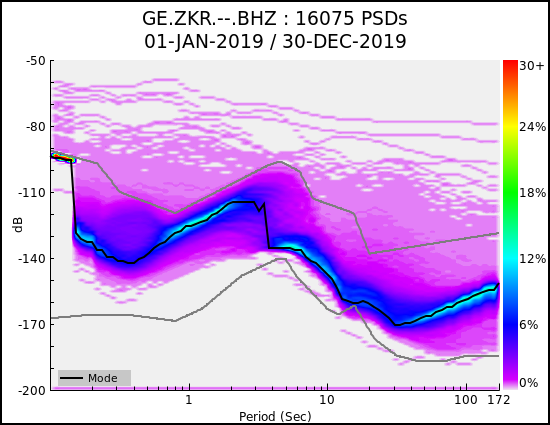
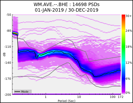
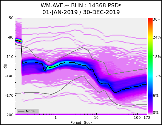
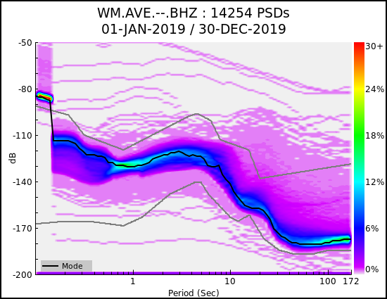
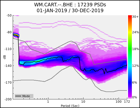
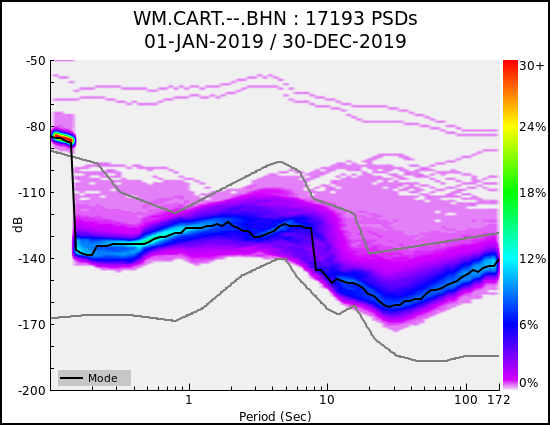
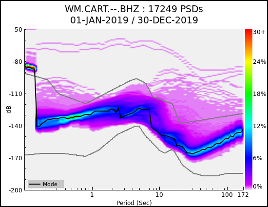
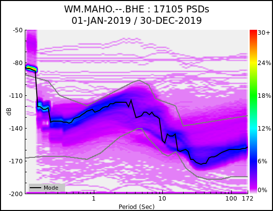
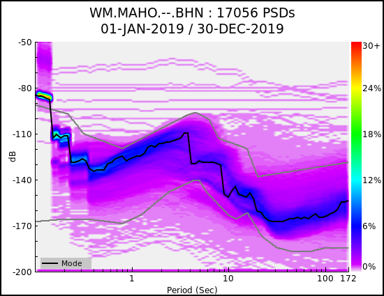
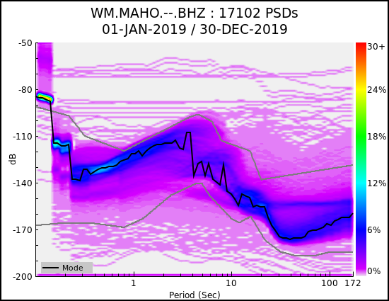
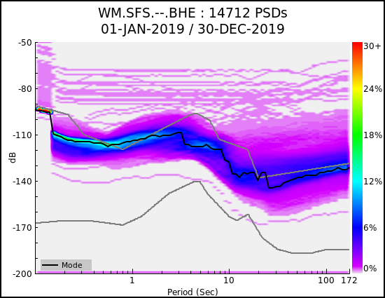
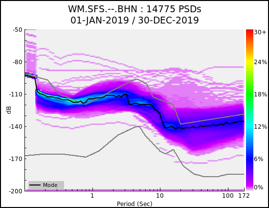
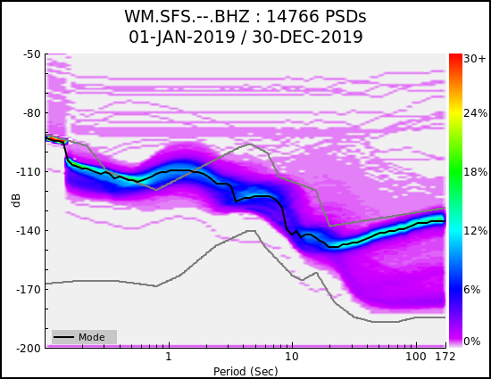
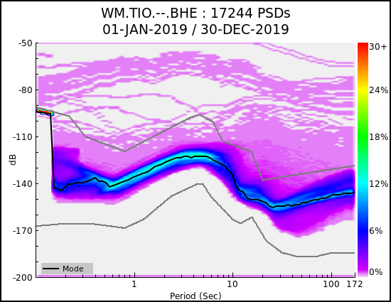
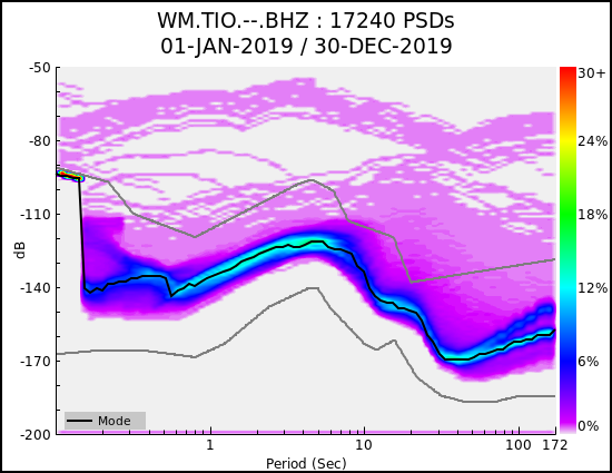
Probability Density Functions (PDF) for operational GEOFON stations 01.2019 - 12.2019¶
The PDF displayed in this appendix have been calculated with PQLX v. 2011.365.P4 (McNamara & Buland 2004) only for the primary channels, that is generally a Broad-Band sensor at 20 Hz. Only operational stations during the year have been included, stations that were off-line for most of time are not included in this appendix.
|
|
|
|
|
|
|
|
|
|
|
|
|
|
|
|

|
|
|
|
|
|
|
|
|
|
|
|
|
|
|
|
|
|
|
|
|
|
|
|
|
|

|
|
|
|

|
|
|
|
|
|
|
|
|
|
|
|
|
|
|

|
|
|
|
|
|
|
|
|
|
|
|
|
|
|
|
|
|
|
|
|
|
|
|
|
|
|
|
|
|
|
|
|
|
|
|
|
|
|
|
|
|
|
|
|

|
|
|
|
|
|
|
|
|
|
|
|
|
|
|
|
|
|
|
|
|
|
|
|
|
|
|

|
|

|
|
|
|
|
|
|
|
|
|
|
|
|
|
|
|
|
|
|
|
|
|
|
|
|
|
|
|
|
|
|
|

|
|
|
|

|
|
|
|
|
|
|
|
|
|
|
|
|
|
|
|
|
|
|
|
|
|
|
|
|
|
|
|
|
|

|
|
|
|
|
|
|
|
|
|
|
|
|
|
|
|

|
|
|
|
|
|
|
|
|
|
|
|
|
|

|
|
|
|
|
|

|

|
|
|
|
|
|
|
|
|
|
|
|
|
|
|
|
|
|

|
|
Fig. 10 GE Network PSDs (2019)